Salkantay Trek Day 4- Llactapata


Day 4 Highlights :

1. The Llactapata Ruins- RIGHT in front of Machu Picchu
2. The various views of Machu Picchu (above, across, below)
3. Getting to hike along original Inca trail
4. Sunrise on a stunning valley
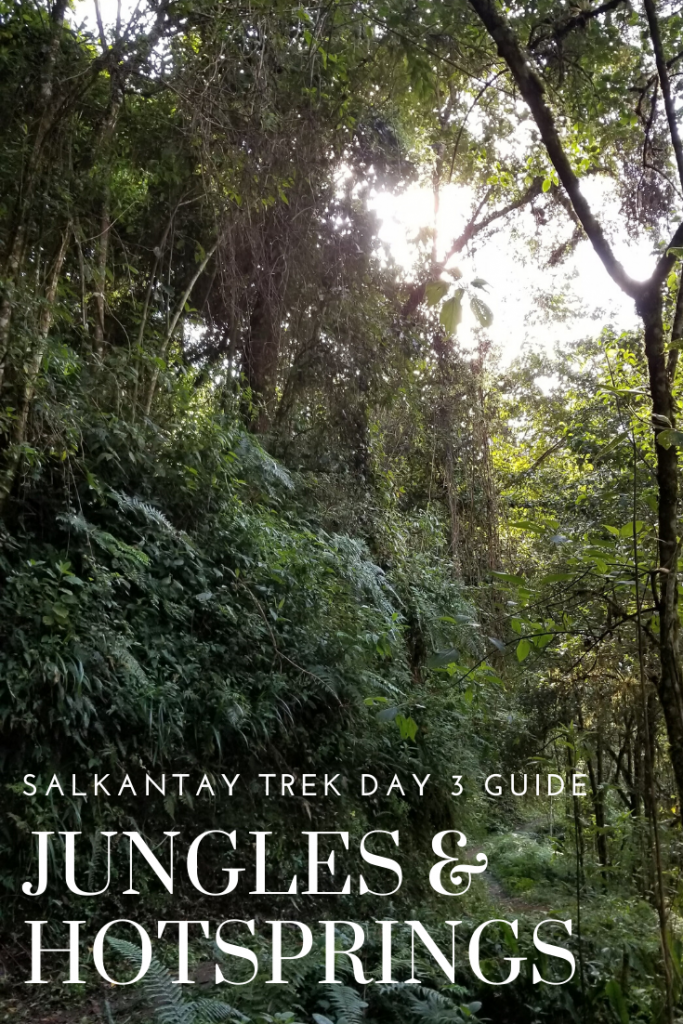
5. Continued jungle wildlife- especially birds 


Day 4 Stats:

Distance: ~18km or 11.5 miles
Elevation: ~2,500 feet up, ~4000 feet down
Time: 9 hours with stops
*You can shave off 3 hours and at least half the mileage by paying $30 and taking the train from Hydro Electric to Aguas Calientes.  
 
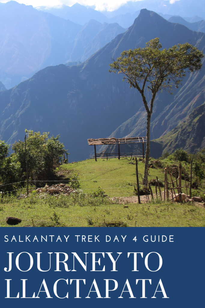
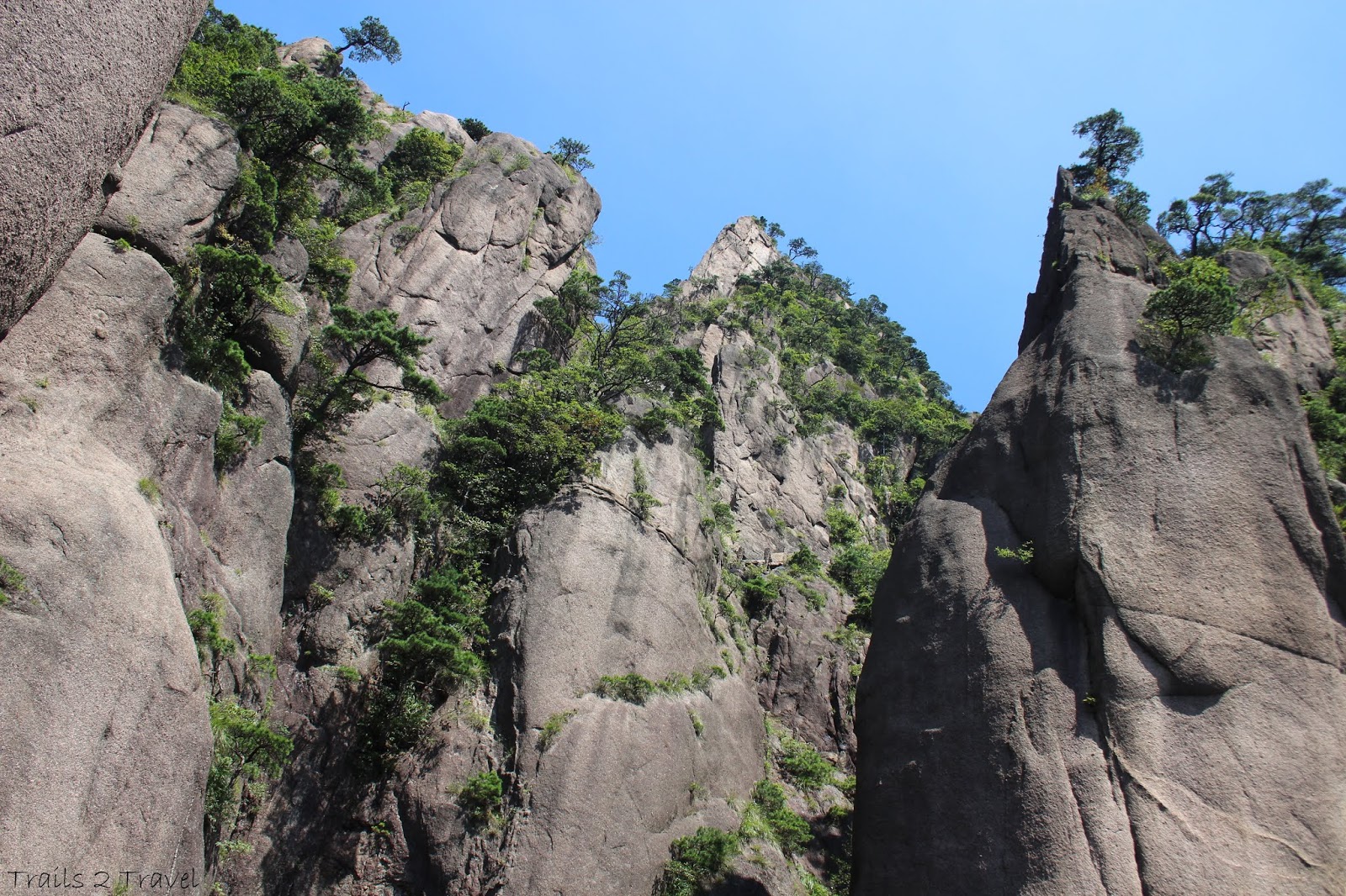
Our morning started with epic views on the hike uphill to the ridge
Day 4 was our earliest start on the trail, with a wake up of 4:30 aiming to leave 30 minutes earlier. While we had electricity in camp the night before, the power was out for the area in the morning so it was DARK indeed. We ate breakfast using the collection of headlamps our group had ( I can’t imagine how they cooked stuff for us) and packed our stuff up as normal. This was our last morning with our chefs who we tipped and said goodbye to before hitting the trail at 5:30. The first few hours of the trail were steady uphill and we raced to be done with the uphill before the sun heated everything up. Watching sunrise over the valley was STUNNING and overhead flew parrots squawking and making a ruckus so even with a few hours of sweaty uphill, the morning was a killer hike.
 
 
The trail this day was 100% Inca made and required permits to enter which our guide supplied at the start booth. After about 1.5 hours of steady sweating, we took a break at the only stand on that side of the ridge where people got fresh orange juice for a dollar and others used the open air toilets (they were pink!) on the back side of the hut with incredible valley view below. There was a cute puppy wandering around we all shared snacks with before pressing on for another 45 minutes or so to the summit of the ridge. Then it was about 20 minutes downhill to the Inca site Llactapata.
View from our break spot- Almost to the top of the ridge!
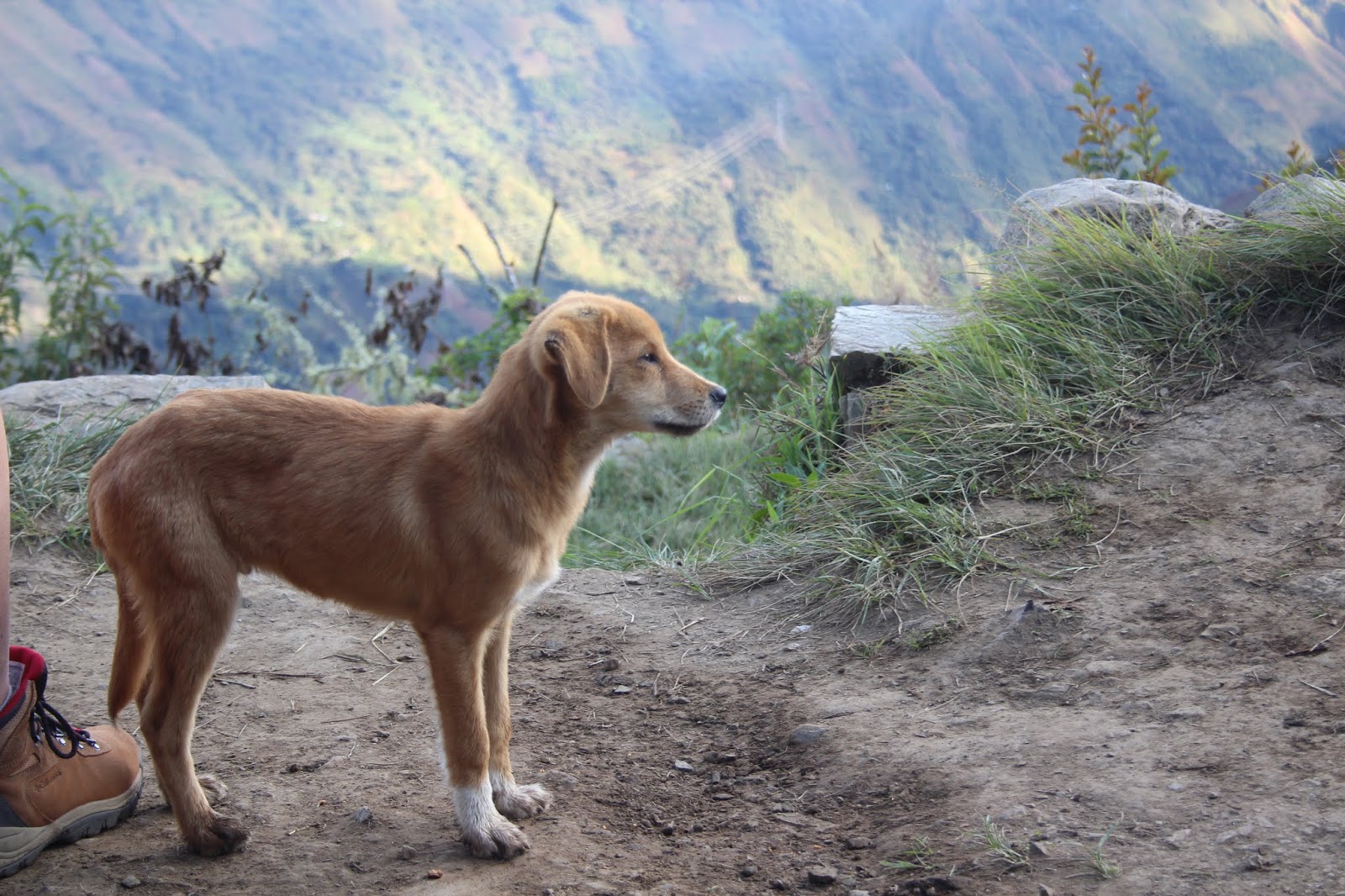
Adorable dog at our break spot
Even though we were sweaty and most definitely tired of going uphill, some parts of this trail were just complete magic.
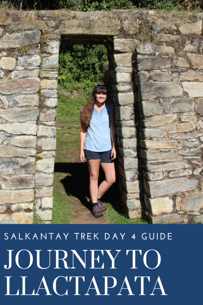
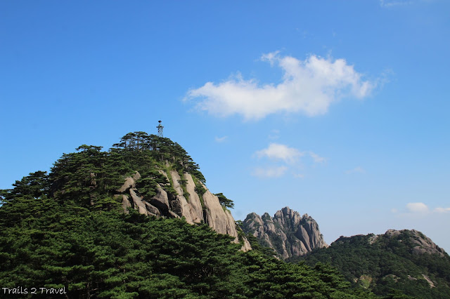
 
Llactapata 
The name of this site means elevated place or “at the top of ” and has a direct view across to Machu Picchu (albeit a little higher up) and had an ornamental fountain and gate that framed Machu Picchu perfectly.
 
A lot of the site was still overgrown meaning what we saw was only the tip of the iceberg here but wow, the views across to Machu Picchu as well as being able to look to the side and see Salkantay mountain was mind blowing. We’d come so far and were within sight of our final destination!
 
We took another break here, eating snacks and snapping photos while Carlos explained more about the site and its connection to Machu Picchu. He explained it was used as a preparation place for the wealthier/ more important Inca families as they traveled to Machu Picchu. The site was initially reported by Hiram Bingham in 1912 (same explorer who discovered Machu Picchu) but wasn’t actually extensively explored and mapped until 2003.
The main buildings that are uncovered at the site
Can you spot Machu Picchu’s terraces?
The central gate
 
 
I loved exploring this site
After a brief rest here, we pressed on another 30 minutes or so down steep, muddy switchbacks to another rest stop called Llactapata Lodge (you could actually spend the night here) where more toilets and snacks were available. At this point a few members in our group were struggling with the downhill (knee pain) so our numbers were spread thin as everyone moved at their own pace. We didn’t stop again for another few hours until reaching a small shack where we stopped to wait for Carlos to catch up at least and guide us on.
 
He walked us 15 minutes further to our lunch stop at the restaurant Aobamaba while he ran back up to assist the last people in our group. Lunch here was a family owned restaurant right overhanging the river. We had a type of yellow curry over rice that was delicious and were able to rest a while and digest while waiting for the last of our members (who caught up to us) to finish their meal. We were finally about done with the uphill/downhill game but we still had a LOT of walking ahead of us.
View from Llactapata Lodge
Continuing down the trail, we caught site of a beautiful waterfall just in front of the Machu Picchu site. So beautiful!
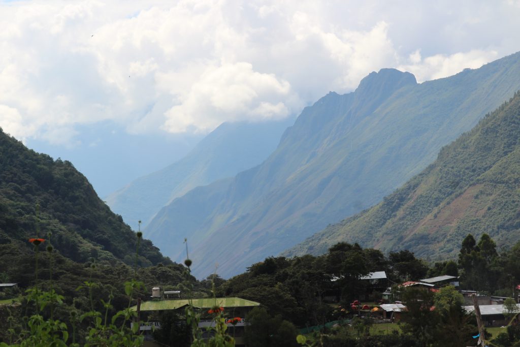
After the restaurant we came to the long, and a bit scary suspension bridge that spit us out just below a waterfall running down from Machu Picchu.
 
After the waterfall we reached the small town of Hydro Electric where you have the option (for $30) of riding the train the rest of the way into Aguas Calientes. A couple of people opted for this option to save their feet and knees but the majority of us pressed on for the final 3 hour walk to our lodging for the day. The trail cut across 2 of the switchbacks the train takes through massive banana trees before then just following the train tracks the rest of the way.
Passing along the bottom of the same waterfall we’d seen in the distance. It was HUGE.
Almost to Hydro Electric
At hydro electric looking straight up the base of Machu Picchu Mountain. That line cutting across the center is actually where the Inca Bridge is (you can hike to it from Machu Picchu as part of your ticket)
It was a BEAUTIFUL walk with the river on one side, and often little streams or falls flowing in from the other side of the tracks. In a couple places you were forced to walk ON the tracks as there wasn’t a separate bridge for pedestrians.
The trains passed us pretty slowly allowing for plenty of time to hear and get out of the way. Eventually our guide caught up to us and guided us off the train tracks and down to the road that would take us straight into town. Unfortunately for us, our hostel for the night was on the upper far side of town. We all settled into our rooms for showers to clean up and nap a bit before dinner.
 
*Tip pack your soap and change of clothes in your day bag for this day as you barely get your duffel bags before dinner. The room was pretty nice in that it was cooler, with decently comfortable clean beds! (after 3 nights in a sleeping bag, the sheets and bedding were a welcome respite)
 
The trail cutting across the train track switch backs through epic banana tree forest
 
The train tracks are so scenic
 
View from the tracks looking straight up to the bottom of Machu Picchu
Crossing the tracks as there weren’t any pedestrian bridges
Watching a train go by.
 
After 3 hours of flat walking along the train tracks we finally made it to Aguas Calientes. (the launch pad town for Machu Picchu)
 
We walked as a group from the hostel to a restaurant where we had dinner (in much the same fashion as we had along the trail) and here you could also order drinks but they were not included in the tour price. (It was again difficult to pay for things when we were charged as a group for drinks… try to have close to exact change and small bills)
 
After dinner we walked as a group to the bus ticket office a block away where we could purchase bus tickets to Machu Picchu for the following morning. Out of the 11 of us including Carlos, only 2 chose to continue the trail and hike UP to Machu Picchu from Aguas Calientes. The bus tickets cost $15 pp round trip and was well worth it as the trail to MP from town was straight up LARGE steps offering no other perspective than what you can get from the bus. After purchasing our tickets, we were able to wander town a bit if we chose and make our own way back to the hostel on our own. But with a VERY early morning the next day, most everyone headed back to bed.
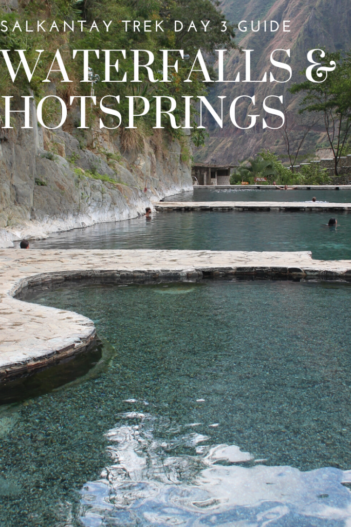
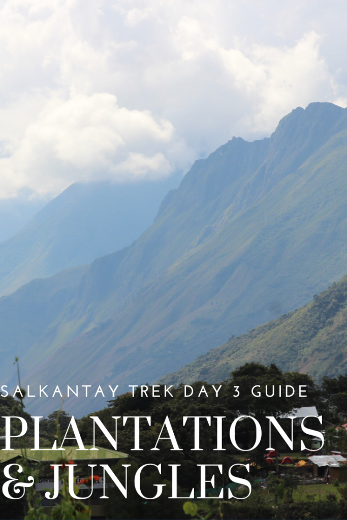
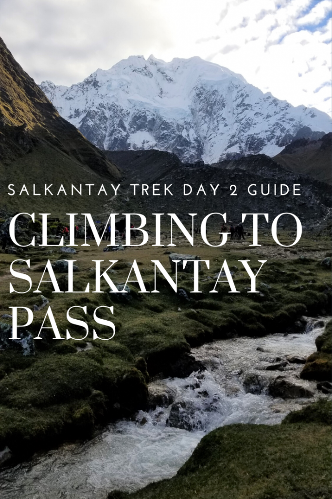
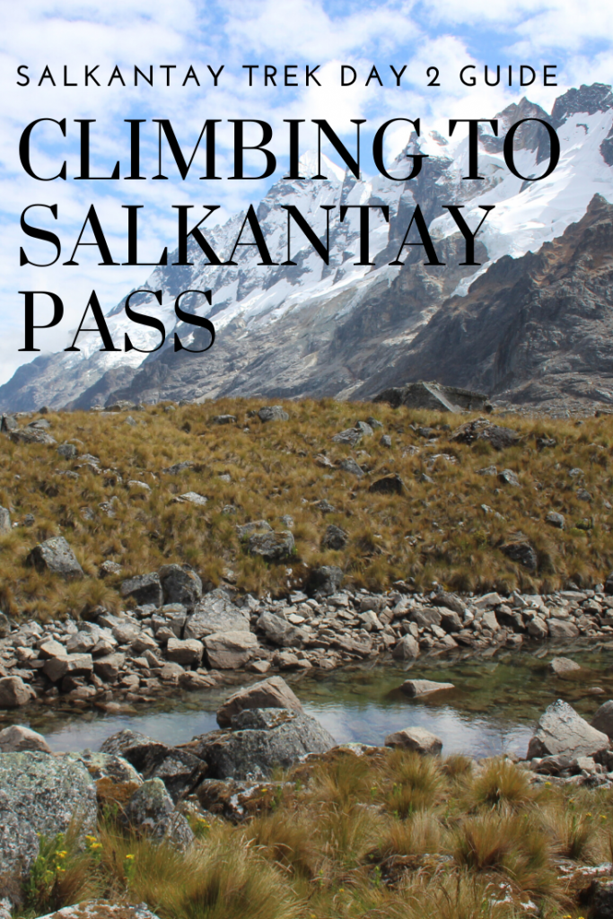
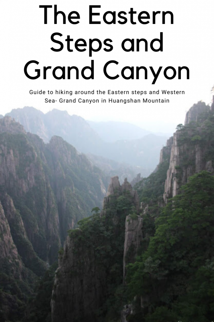
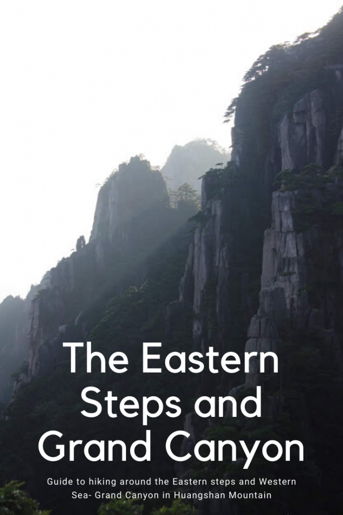
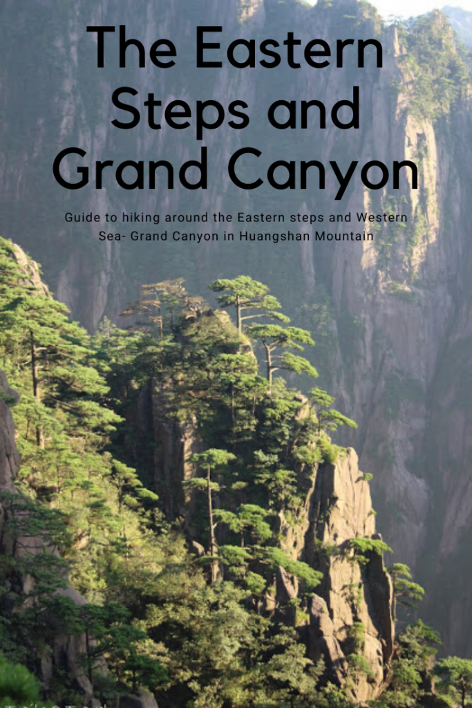
 

Pin me:

Salkantay Trek Day 3- Waterfalls and hot springs

 
The camp we started at looking up the canyon we hiked the previous day

Highlights of Day 3

1. Waterfalls
2. Soaking in hot springs
3. Visiting and learning about many plantations along the trail
4. Sampling plantation wears.
5. Definitely getting our faces painted with trail side berries
 

Day 3 Stats:

Distance: ~18 km/ 11.5 miles
Elevation: It’s up and down all day ~1000 feet up ~ 2000 feet down
Time: 6 hours hiking, 2-3 hours at the hot springs

How our day went:

 
Day 3- Supposedly the “easy” day which I’d say it was really only easier in the fact that it was the shortest and lowest altitude day. It probably had at least 1000 feet of up and down gain/loss through the jungle and after the previous hard day, it definitely didn’t feel all that easy.

The first of many waterfalls of the day
 
A sign along the road showing the turn off for the trail
 
It started the same as before- 5:00 wake up time, 5:30 breakfast, 6:00 Depart. We walked through the outskirts of town along the road for a while passing a magnificent waterfall along the way. We stopped to admire a trumpet flower, and Carlos painted our faces with a berry that is used in textile dye. (We had some pretty ferocious faces after that)
 
Our trek continued down the road a ways before turning off on a trail crossing the gorge on a really cool bridge- setting the precedent for cool waterfall crossings of the day. Then there was about a 30 minute climb up in which almost all of us sweat our berry paint off. I had to stop at the top of the hill to shed some layers and take a wet wipe to my face. (and some bug spray to the rest of me)
The first (and coolest) bridge we crossed
Check out that face paint (bangs kept mine at a minimal haha!)
Looking back from higher up at the crystal blue water
 
While there was tons of beautiful scenery on day 3, it all kind of blurred together. We stopped for our first break stop at a passion fruit farm and shortly after that passed a stunning 2 tier waterfall. A lot of the trail had some steep drops off down toward the river and was loose dusty footing. We passed several more fruits and snack stands, stopping at a couple to make use of facilities or make purchases. All in all we walked for roughly around 6 hours in total for the day.
Another bridge crossing some falls along the trail
The biggest waterfall of the day
 
We followed the river for a lot of the day
The trail was beautiful but more difficult than we all imagined
Steep drop offs from the trail
One of my favorites showing how small we all were in the jungle
Fruits stands along the way- The Popsicles are delightful
A lot of the homes and fruit stands don’t have any roads running nearby but there was a major road on the other side of the river. We passed multiple wires crossing over that had a large basket used for transporting stuff across the way. (at one they were even moving tourists along, I’m guessing those who followed the road and needed to cross over the trail side)
We eventually reached some towns where we stopped for our 2nd break at a coffee farm. Carlos showed us how coffee beans are processed which was really interesting, and we got to sample some as well. (You can even purchase some coffee beans or ground coffee to take home) From there it was going to be another 45 minutes or so of walking or you could opt to take a free van ride to the 3rd camp…. Most of the group chose to walk but as the walk looked to be more through little towns without much change in scenery, I chose to give my feet a break and hitch the ride.
Grinding up the softer outershell of the coffee flower to reveal the beans (still needing to be roasted)
The sample/ shop
 
When we got to camp, the hosts showed us where our stuff was dropped off and allowed us first pick of the jungle domes. There were the largest of the lodgings but the least ventilated. Definitely DON’T leave your shoes or wet clothes in there. I set out to take a few photos around camp and since we had the place to ourselves, I found the only hammock where I set back to relax and enjoy the nature around me.
 
Also I’d like to note here you can purchase beer for $2 at the camp here. Another thing to bring cash with you for. 
 
Once our fellow trekkers arrived and checked out their domes, we got lunch which was another spectacular affair. Not only was our appetizer ceviche (a raw fish soaked in citrus juices with some chili/ spices thrown in) the presentation of all our food was the best so far. Lots of fun food critters and of course, everything was delicious
 
Our 3rd night/ last camp along the trail. The next night would be in town
The orange dome with a hammock
Note the socks and sandals.. It is generally a bad idea to just wear sandals around Peru as there are biting flies and sand flies/ no seeums. Any time I wore shorts I liberally doused my legs in deet but found it easier to just wear socks with my sandals than cover my toes as well.
Lunch = AWESOME
Our app of ceviche
potato cakes
beans awesome details on the turtle!
After lunch we all changed into our swimwear and climbed aboard the Hot pots express (about an hour each way bumpy van ride) that took us to some hot pools by the river in another town. This was one of the add ons you will need cash for and I had NO idea about until the day before our tour. Definitely don’t pass this up!
View from the entrance to the hot springs
There were 4 large pools each marked with their temperature. It was heaven having the place to ourselves when we got there.
We were among the first to arrive there so got to enjoy multiple pools almost to ourselves. *Make sure you shower off before entering as you will get whistled at, and you will have no idea why haha. They had several pools of varying temperatures, with a couple getting VERY hot. You could actually swim lazily around in them, or find seats built into the stone around the sides. At the far end they had cold showers in the forms of waterfalls coming down the rocks, and warm showers you could sit beneath which were wonderful. And just past the pools you could glimpse the raging river so while the pools are not natural, the hot springs and river gave it a natural feel. We had around 2.5-3 hours to spend there and we lasted about 2 hours in the water before getting too pruney.
 
BRING YOUR BUGSPRAY WITH YOU. While I could typically make the dash between pools and showers without feeling swarmed, the second we actually started drying off, the mosquito cloud was intense. I probably got 8 bites in the 1 minute it took me to dry off and spray myself down. After getting out they have a bar where you can purchase beers/drinks/ snacks until the van ride back.
 
Entrance to the hot springs
The ride back was almost in the dark and took quite some time, but we all felt much more relaxed and clean upon return. We had our happy hour and dinner in the dark around camp (our last dinner with our chefs) and it was another stellar number.
After dinner, our guide had us move up to the home at the entrace to the camp site where the hosts had a bonfire going! We all sat around enjoying watching the stars and the flames flickering. From what I saw, none of the other groups bunking in our camp (there were maybe 2) got the bonfire treatment so we felt incredibly special. It was a blast of an evening!
 
From there we were all just about ready to hit the sack when there were 1 or 2 choruses of yelps/ screams from other domes where an invading spider surprised the new inhabitants. Shaenah and I remained blissfully unaware of any visitors in our dome, but that didn’t stop us from taking the bug spray to any spots that were less sealed looking along the ground.
Another incredible adventurous day along the Salkantay trek.

**Note if you choose the 4 day trek instead of the 5 day, you miss out on the coffee plantation, hot springs, and jungle dome camp.

Pin me:

Salkantay Trek 2- Conquering Salkantay Pass

Highlights of Day 2: 

1. THE BEST VIEWS OF THE ENTIRE TREK
2. Experiencing the change of scenery from alpine to jungle
3. The fun jungle huts and being DONE with the hardest day

Day 2 Stats:

Distance: 22km/ 14 miles
Elevation gain: 3,000 feet
Elevation loss: A whopping 6300 feet
Time: 10 hours

 
If Day 1 was the warmup, Day 2 was certainly the main event, the big kahunas, the “challenging” day. It also set the precedent for our daily routines. We were woken up at 5 by our guide bringing us Coca tea in our beds. (room service as they called it) and with camp 1 being so cold, the tea was definitely a welcome wakeup. Ater that, we were in for QUITE a day.


We had 30 minutes to prepare for the day, arrange our daypacks and repack our duffels, brush our teeth, and re-stuff our sleeping bags. At 5:30 we met with everyone for breakfast which was a quicker affair than other meals but still delicious. We’d have 4-5 platters of food options, a variety of more teas, a breakfast juice, and at the end we’d get our snacks/ purified water for the day.  After eating, we’d have about 10 more minutes to use the toilet, and make ready to go with a depart time targeted for 6AM.
 The beautiful sunrise on our glass domes
 
 
After a VERY rough night for me stomach wise and freezing I didn’t get much sleep and couldn’t eat much breakfast. Luckily one of our comrades in the group brought Imodium pills which is likely what got me through the day.
 
 The hike out of camp was mellow for a bout… 10 minutes before starting to climb up. I wasted no time in breaking my hair tie (again thankful for prepared group members who had extras) and it took around 1 hour to get to our first meeting spot above camp and at the base of Salkantay mountain at Salkantaypampa (13625 feet). It was a beautiful morning, perfect weather and with little pink clouds rolling through the valley. We passed multiple streams and a few llamas (a couple which gave us a show…) and from our break stop we could look down on our progress and see our camp down at the bottom of the valley. All in all, not a bad start to the day with just under 1000 feet of gain. (935 feet)
 
 Llamas spotted running through the meadows
 
Looking back at the start of our day- our first camp is located in the valley just under that cloud
Salkantaypampa
Behind me you can see uphill climb part 2 which is the start of the dreaded seven snakes
 
The next section of trail (uphill part 2) would be the most difficult. There was a decently steep climb to the base of the infamous “seven snakes” switchbacks and we reached those just as the sun was coming up. While our group started to take breaks to sunscreen up, I carried on until I was at least IN the sun and shedding layers before I bothered with the the sunscreen and even then I tried to keep my momentum going with minimal breaks.
 
At these switchbacks we ran into the pony trains which got frustrating as we were forced to let lines of horses past us only for them to stop a few switchbacks up and we’d re-pass them. It was also super having the 50+ people who did NOT hike this section all on horseback trying to tell us good job when I was feeling probably as low as I’ve ever felt on an uphill climb. Luckily it wasn’t too long before I reached the top where a bunch of big boulders with awesome views of Salkantay mountain greeted me along with a few fellow people from my group. I met up with them and we continued to the next meeting/ rest spot at Suyrooocha (14,730 feet) to eat a few of our snacks, use the toilet, and prepare for the last assault. All in-all part 2 of the uphill climb was around 1200 feet (we lost about 100 feet after the seven snakes)
 
Views from the trail of the Seven Snakes. Straight ahead is the right trail (“shortcut” route) which gains about 100 feet less than the switchbacks as it meets up with the main trail later on. The views were better from the seven snakes but in hindsight- I’d have taken the right fork to avoid all the mule trains.
(However our Salkantay Trekking group shirts say “I survived the trail of the Seven Snakes” so… of course I had to do that route instead)
Reaching the top of the switchbacks
 
Soaking in the sun and views of the incredible Salkantay Mountain
Our break stop was just past all these boulders
 
After our daily snacks devoured, we set out for the final climb of the day- only 483 feet to Salkantay Pass. It was a fairly steep climb but after about 20 minutes/ bend in the trail, you could see the final destination which always gives you a little burst to get to the top at 15,213 feet.
 
The pass was COLD.
 
While hiking up in the sun with little to no wind had made us sweat, breaching over the pass was very windy and some clouds rolled in as we got there. It was a godsend however that our cooking crew were there with a big thermos of hot coca tea and baloney/cheese sandwiches (I picked the baloney off and settled for just the cheese) We all layered up and took our group/ individual photos for about 30 minutes before getting ready for the next challenge: the downhill.
 
Looking up the final hill to the pass
Views from atop Salkantay Pass
 
Looking back from where we came. The trail curves around to the right base of that mountain.
Once again we created an offering to the mountain with stones each of us collected along the trail and carried up with us.
Right away as we started the descent I could tell this would be my favorite stretch of trail. All around us were big peaks playing hide and peak behind clouds, giant boulders and alpine flowers, all with a huge valley splayed out before us.
We were once again allowed to hike at our own pace so I spent a bit of time walking by myself, and bit of time chatting with others from my group who were nearby. It took quite some time to get to our lunch spot (around 2.5 hours of downhill) at Wayracmachay at 12812 feet so we were all pretty ready for a break. Especially considering we’d already descended 2,401 feet in the span of 2 hours.
Starting the trek downhill from the pass
 
 The views of where we were going- it was definitely alpine terrain
Everywhere there were horses and mules grazing- often times amongst old Inca ruins or abandoned farms.
A short breakstop on the way down- only halfway to lunch
Some of the amazing horsemen that carted our stuff ALL THE WAY from our first camp down to our 2nd camp, and then went back up over the pass.
AMAZING TRAIL
Bridge crossings along the trail
The first sign of civilization we saw in a while- still 30 minutes to lunch spot
An interesting pigpen we spotted on our way to lunch.
 
 We finally made it to the tents that contained our lunch. The meal this day was probably one of my favorite meals of the trip. Again we had a small app, soup, and then 6 platters of food including trout which I really liked. We were able to refill our waters (as needed) before then hitting the trail again for another 2,500 feet of loss.
 
 
Carlos kept saying it would be more gentle- less rocky after lunch… but honestly it was still just as steep in spots and still a LOT of downhill. If you were using poles, keep them out ! It was definitely a change of scenery as we hit the jungle. Just about everything in the scenery was different and it couldn’t have felt more wild of a transition. There were hummingbirds bigger than my fist, flowers as long as my forearm, and rain forest trees as far as you could see.
 
 Along this route, we only had 1 more meetup stop to make sure everyone was coming and that was at Rayanniyoc (11,460 feet). Bathrooms and snacks were available here and I believe a few people invested in a powerade but most of us were just ready to be done so we didn’t rest for long. Then it was onto the village of Chaullay where our camp would be for the 2nd night at 9,414 feet. (Total loss from the day was 6300 feet!)
 
Changes of scenery
Break spot
My favorite flower was those yellow ones that look like birds from a distance
 
The canopy of trees was UNREAL.
 
Looking back up the trail, you can’t even tell we were just walking amongst rock giants and snow
 
Our camp here was the most “rustic” as far as toilets went (only 2 stalls with no toilet seats) but was quiet and nice. The huts were up off the ground about 2 feet with little steps to get in and again there were 2 twin beds with super comfortable mattresses.
We did NOT have electricity here but you could pay 10s ($3) for pretty fast wifi and another 10s if you wanted to take a hot shower. As we settled in, people rushed to get on the sign up sheet for showers (30 minute blocks I believe) and others headed for cocktail hour. (Seriously hot cocoa and popcorn after a long day of hiking might be my new go to) We had a little time after cocktail hour to rest but it got dark very fast so there wasn’t much to do besides hang out around the only light- the mess area or sit in the relative dark of the huts.
 
The early shower blocks were full and as nice as those sounded (literally you could see the steam and hear the people sighing from the open air shower) I knew once it got dark the bugs would be all about that light in there.. so I forgo the shower in favor of the hot springs/ shower I knew we’d get the next day. We had a slightly later dinner at 6:30 but everything was as delicious as before. It wasn’t too long before we were then all headed for our beds ready to pass out after a 26 km day.
 
Camp 2
Dinner and Dessert- Stir fry and Red corn pudding

Day 2 of the trek extra costs:
$3 for a hot shower
$3 for good wifi
Cash at any of the stands for powerades or sodas.

Pin me:

Salkantay Trek – Humantay Lake

Salkantay Trek – Humantay Lake
 
The moment you’ve all been waiting for, and most definitely my main excuse for visiting Peru… I give you the Salkantay Trek. I’ll likely write up an overview of this trek/ tour to compare with the Inca trail tours but to start with you may just wonder why choose one over the other? Here’s my top reasons:
  1. Less Crowded (though that is becoming less so as word is getting out about the beauty of this trail)
  2. LESS MONEY– Salkantay treks are much more luxurious (I’ll get into that) for less money
  3. Let me emphasize LUXURIOUS. Our tour had enclosed domes/huts for 3 nights with actual BEDS, 3 course meals, snacks + “happy hour” (more on that later), electricity and showers some of the nights, and the use of horses if needed.
  4. More Flexible. Can be booked only a few months in advance instead of a whole year- plus you get more options for dates you like. Since this trail isn’t permitted like the Inca trail, you don’t have to plan this trip 1 year in advance.
  5. Arguably more BEAUTIFUL. This can be debated but when I looked at photos from each tour, I found the Salkantay trek scenery to be so much prettier and more diverse. Gorgeous mountain lakes, glaciers, jungles, and yes you still get to see off the beaten track ruins – 1 of which gives you direct line of sight to Machu Picchu.

About our tour:

It was as luxurious as a trek can get and more beautiful than I even imagined. It was hard- but not harder than I figured it would be. The company was well organized, the guides, porters, cooks- all amazing human beings that I can’t imagine a tour of this scale being successful without. And it was all wrapped up in a shiny package at only $450 for 5 days. 5 days friends!
Click here for more info on the tour

Day 1: the hike into camp

This day and day 2 tied for first place on my favorite day in Peru. Even with the early pick up from the Plaza de Armas at 4AM…. We met our guide and hopped in the van for a 3 hour drive to the start of the trek. They passed out blankets on the van so people could continue to sleep (but not me) and our whole group (10 of us) were loaded on. The first part of the drive was quite long- it didn’t start to get light until 5:30 and the road was twisty and bumpy at times.
 
 
After around 2 hours we arrived at the town of Mollepata for our breakfast stop. We had 30 minutes and the place was very efficient. For 15 soles, we got espresso (pre made and bottled) teas, juice, fried eggs, and lots of bread which I used to make egg sandwiches. We all ate, used the banjo, and loaded back in for another 40 minutes up the mountain. The views driving up from here were amazing though as we looked out over the clouds we wondered just how much higher our chariot would take us. The road was a dirt road and quite bumpy- not too mention a little scary with drop offs at times, so when we saw the end we were all quite happy about it.
Bathrooms at the trailhead.
 
At the TH, the group loaded up on sunscreen, once again made use of the facilities, and got our gear all in order. Our guide assured us this day wouldn’t be too bad and he was right. There was about 30 minutes of climbing switchbacks which ordinarily wouldn’t be hard, but at 12,000 feet- were quite challenging. It then leveled off for the remaining 2 hours or so of our hike to camp.
 
The views looking up at the mountains ahead were incredible, and equally amazing were the views of valley we drove up. Carlos pointed out special plants and began teaching us Inca/ Quechua vocabulary like Pachamama (mother Earth). We followed some irrigation ditches, crossed a couple bridges, passed a few cows, and in general enjoyed the beautiful trek into camp. We stopped about 20 minutes before to have our snacks and rest before arriving at maybe the best camp I’ve ever stayed at. (and could’ve enjoyed for many more nights)
 
Total miles to camp: ~6 miles
 
The group leading the way to the base of Humantay Mountain with Salkantay peaking through on the right. Our camp would be in the valley of the two.
Looking back at the mountains we drove up. The trail is the higher road on the right, the driving road is lower on the left.
 
Walking along the irrigation ditches still used by farmers today
A view into camp- still a ways away.
Beautiful views along the trail in the morning
When we got to camp, we picked the first dome in the row of domes our group was assigned and found it to be the BEST little home away from home. We had 2 single beds with the most comfortable 4-6 inch foam mattresses we had our entire trip, a small light, charging outlets, glass ceiling for star gazing, clean blanket and pillow (to add to our sleeping bag setup) and best of all- an insane view out our door.
 
We lay in there with the door open for a breeze, gazing out at the horses grazing beneath the most stunning mountain I’ve ever seen- Salkantay. We had an hour to nap so we laid down and I even noticed a few mules wander up to munch on the grass by our front door. Eventually I gave up on the nap and walked out to sit on the porch chairs and enjoy the sun.
 
Looking into our dome- the tarp was to keep it from getting too warm during the day
 
The INSANE view from our doorstep
Friendly mule looking for snacks
Looking down the row of our group’s assigned domes. We even had nice park benches to sit and enjoy the view from.
After our hour siesta, we had lunch which was a fabulous 3 course meal – followed by yet another 45 minutes to nap/ relax/ and digest before the 2nd part of our hike for the day. (apparently it takes longer at higher altitudes to digest) Once again napping was fruitless for me but I still really enjoyed relaxing around camp in the sun.
We got the best seat in the house as well. (though disclaimer, it was very hot)
 

The hike to Humantay lake

You could see our next hike from our camp: a steep (very steep) hike up to Humantay lake which was just out of view. At home, I would look at it and think “sure that won’t be easy but it also won’t be too bad…”
Let me tell ya- after a few hours of sitting around and a big lunch- it was bad. Starting out I was the slowest one, wishing I’d brought my poles and just having the hardest time pushing myself up the hill. Eventually I got back into the grind of everything and since when I hike, I HATE stopping to take breaks, I cruised up and was the 2nd to the top. Carlos gave us some coca tea leaves to chew on (which were gross) and I can’t attest whether they actually helped or not. What DID help, was playing epic soundtrack music on my phone.
 
The view looking back down at camp in the bottom of the valley- we already had come quite a ways.
The trail got SO steep at times.
 
 
When we finally rounded on the lake, all our jaws dropped.
I mean- this was THE MOST beautiful lake I’ve ever seen. Crystal clear lake that reflected the most beautiful turquoise when the sun hit it, sitting under massive glaciers on a jagged mountain peak. My favorite part? The 2 dueling crater like ridge lines that framed the lake perfectly. We took some group photos on the shore before heading our separate ways to get a view from higher up on the ridge. We had about an hour to hang out before meeting back with Carlos to learn a few more Inca phrases, and make an offering to the mountain. The offering came from all of us selecting rocks and stacking them into a cairn. We then each got to say something along the lines of “Here is our offering, bless us mountain and mother nature” Then it was back down everyone at their own pace
 
Insanely beautiful lake
The 2 dueling ridgelines that were so unique compared to other mountain lakes I’ve seen
Rock offerings from the groups that came before us.
 
Oh ya, the glaciers up there weren’t bad either
I moved pretty quick downhill (since there was no where for privacy to pee up there) but I still enjoyed taking in the view and even raced a couple horses as they ran down to dinner.
 

Back at camp

Back at camp, we got our first happy hour. We again got the best table with a beautiful view of the mountain while we nibbled on popcorn, cookies, hot chocolate and hot teas.
 
After that we got another short break to change into warmer clothes and watch the stars come out. Dinner was an amazing affair following the same theme as lunch with a small appetizer, soup, and then 6 platters full of food. We spent more time getting to know our fellow hikers and guide before we then got to meet the rest of our amazing team! We had 2 cooks that were both younger than me and a horseman who would help move all our things from day 1- over the pass- to our 2nd site. They were all so smiley and nice, it was awesome to thank them in person for our incredible meals and experience. Our dinner was then followed up with flaming bananas in rum for desert and then a mint tea to help with digestion.
 
Racing horses down for our meals.
The happiest valley I’ve ever seen
Bundling up before dinner
Enjoying the views without our tarp on the dome.
Our dome was right next to the mess house.
Happy hour
As we headed to our domes, the milky way was out and visible, Shaenah and I both started looking for the darkest spot we could find around camp. I grabbed my little tripod I brought hoping just for this and managed to find a spot 3 tries in. It was COLD once it got dark so I didn’t try for long but was happy I got to take a few shots of the stars and our domes all lit up in the night. We then snuggled into our sleeping bags under our additional blanket for the night.
Awesome conclusion to an awesome first day on the trail.

Pin me!

100 Hike Challenge

About:

Why 100? Why hiking? Well let’s just say I have a favorite hobby, and that hobby is hiking. I love the feeling at piece with nature, the exercise from climbing up hills, the general sense of adventure in seeing new places AND having those places to yourself, and lastly the people in the hiking community! I really love it all (even if I still complain on the steeper trails)

How to accomplish the 100 hike challenge

  • If you haven’t tried the 52 hike challenge yet, give that a go! It aims at getting you to hike once a week for a year. (I was hitting the goal easily by October every year so I wanted to push myself even more and aim for 2/week) 
  • They don’t all have to be hard hikes! My only requirement for myself was that it was a mile long and got me out in nature (no urban hikes ) and I tried to make them as different as I could but with changing seasons, the same trail can look many different ways. 
  • DO try to use this challenge to get a little out of your comfort zone! Whether this takes you to hiking in a different state or to a different hobby, you might find some more outdoor enthusiasm when you find you like hiking to a climbing spot or a technical canyon. 
  • Do use this challenge to see some new places! It doesn’t have to be a different hike every time, but it won’t seem like quite a chore to hike twice a week if you are finding and experiencing new trails. 
  • Which brings me to- ALLTRAILS amazingly helpful app, highly recommend to exploring the trails near you, as well as using the trail map while hiking to ensure you don’t get lost.
  • Invest in some quality outdoor gear, especially shoes! It can be a bit of a process finding hiking shoes that fit just right (speaking from experience of seemingly always having he wrong footwear) so I highly recommend stores like REI which have 365 day gear guarantees! So you can actually WEAR those shoes hiking and return them if they aren’t the best fit. 
  • Highly recommend using a location tracker app like endomondo or strata as well, to track your progress on a trail and at the end know exactly how you did! I love being able to show the stats to my coworkers Monday morning to show just how crazy of a weekend climbing mountains I had. 
  • Last but not least, practice “Leave No Trace”, take nothing but photos, and leave nothing but footprints. 

If you need ideas for hikes out West, in Florida, or amazing international spots, check out my list (and photos of course!) of all 100 hikes I completed in 2018.

Color code is for anything that wasn’t a hike close by in my backyard: Some hikes have links to a blog post! Will link more as I blog about my favorite trails.

National Parks

Bryce Canyon
Canyonlands
Arches
Capitol Reef
Grand Tetons National Park
Grand Canyon

Countries 

The Unities States
The Philippines
China

States
Utah
Wyoming
Florida
Nevada
Arizona

State Parks/ Monuments/ Reservations
Goblin Valley
Escalante- The Grand Staircase
Florida Caverns State Park
Falling Water State park
Valley of Fire
Havasupai Indian Reservation
Antelope Island
Wasatch Mountain State Park

Hikes 1-25
1. Curly Springs Overlook via Dry Canyon 2.5 miles RT 800 feet elevation change
2. Battle Creek Falls 1.5 miles RT 600 feet
3. Jacks Mailbox 2.7 miles RT 1300 feet
4. Rock Canyon to the campground 4.7 miles RT 1370 feet
5. Adams Canyon waterfall 4 miles RT 1400 feet

6. Little Wildhorse- Bells Canyon loop 9.8 miles RT 1700 feet


7. Pleasant Grove “G” trail 2.2 miles RT 800 feet
8. Upper Falls from Nunn’s Park, 3.2 miles, 600 feet
9. The Provo “Y” trail 2 miles RT, 1000 feet
10. Trail of the Eagle, 4 miles RT 600 feet
11. Bonneville Shoreline between Grove Creek and BC, 1.5 miles RT 300 feet
12. Rocky Mouth Falls 1 mile RT, 200 feet
13. Traverse Mountain Ridge, 3 miles
14. Mt Tapyas in Coron, 1,5 miles RT, 700 feet

15. Badian Canyoneering in Cebu, 2.5 miles RT

16. Osmena Peak on Cebu, 1 mile RT, 400 feet
17. Grove Creek, 4.5 miles RT 1600 feet
18. Dry Canyon Orem to overlook, 2 miles RT- 550 feet
19. Hurricane Wash to Jacob Hamblin Arch – 7.7 miles 1 way, 500 feet

20. Jacob Hamblin Arch to Stephen’s Arch- 17.5 miles RT, 1000 feet
21. JHA back to Hurrican Wash TH- 7.7 miles 500 feet

22. Backpack in to Reflection Canyon, 9 miles 800 feet
23. Backpack out of Reflection Canyon, 9ish miles 800 feet

24. Horsetail Falls, 5 miles RT, 1600 feet
25. The Living Room of SLC, 3 miles RT, 900 feet
Hikes 1-25: 112.5 miles, roughly 22,700 feet of elevation change 

Hikes 26-50

26. Bells Canyon to lower waterfall, 5 miles RT 1630 feet
27. Twin Peaks from alternate trailhead, 3.5 miles RT, 1000 feet
28. Grandeur Peak, 8 miles RT, 3000 feet
29. Traverse Mountain Summit- 3 miles RT, 540 feet
30. Battle Creek Falls further up trail- 3 miles RT, 1000 feet
31. Sunglow Canyon- 3.5 RT, 1200 feet
32. Florida State Park compilation- 2 miles 


33. Horsetail Falls Work club lead- 5 miles, 1600 feet
34. Spring in Big Springs loop! 3 miles RT, 500 feet
35. Orem Big Baldy Summit (attempt), 5.5 miles 2400 feet
36. SLC foothills secret sunset spot hike, 3 miles RT 700 feet
37. Pine Hollow trail, 5.5 RT, 1600 feet
38. Heugh’s Canyon Waterfall, 3 RT, 1200 feet

39. Fire Wave, 1.5 RT
40. White Domes Loop/ Rainbow Vista trail, 3 miles
41. Tibble Fork Loop 5.6 RT 1600 feet
42. Lake Blanche 7.5 RT 2600 feet
43. Julie Andrews Meadow 4 RT, 1000 feet
44. Diamond Fork Hot Springs, 5 RT, 636 feet
45. Hilltop to Supai campground, 10 one way, 2500 feet
46. Campground to Navajo and general waterfall exploration, 2 RT

47. Havasu to Mooney, 2 RT
48. Supai Campground back up to hilltop 10 one way 2500 feet
49. False Kiva Trail 2.5 RT 170 feet and Mesa Arch, .6 RT
50. Corona Arch 3 miles RT 650 feet
Hikes 26-50: 109.1 miles, roughly 25,526 feet of elevation change 

Hikes 51-75

51. Delicate Arch 3.5 RT 590 feet

52. Negro Bill/ Grandstaff Caynon 5.3 RT 1700 feet

53. Grotto Falls Payson 1 RT
54. Wind Caves in Logan 4 RT , 1100 feet
55. Twin Peaks from main TH 3.75 RT 980 feet
56. Cassidy Arch CR 3.5 RT 1000 feet


57. Hickman Bridge CR 2 RT, 320 feet


58. Little Wild Horse Slot 3 RT

59. Willow Heights Lake 1.5 RT 650 feet
60. PC Hill 1.5 RT 518 feet
61. Wolverine Cirque Loop 8 RT 2,350 feet
62. Bald Mountain Uintas 4 miles RT, 1300 feet
63. Taggart Lake GTN 3.8 RT 400 feet


64. Delta Lake GTN 8.5 RT 2600 feet


65. String Lake/ Leigh Lake loop GTN 3.75 RT 182 feet


66. Maybird Gulch lake 8 RT 2000 Feet
67. Aspen Grove Waterfalls 3.5 RT 700 feet 
68. Bourbon Lake and Mirror lake loop combined 3.5 RT
69. Sunset Peak via Brighton 6.5 RT 2000 feet 
70. Tibble Fork lakeshore loop 1.5 RT
71. Buffalo Peak 3 RT 850 feet *
72. Mt. Superior loop 4 miles, 4,424 feet
73. Sugarloaf Peak 5 RT 1700 feet
74. Battle Creek Falls baby hike 2 RT
75. The Great Wall Jingshanling section 6 miles point to point – no idea on elevation change but it was  ALOT
Hikes 51-75: 100.1 miles, roughly 25,362 feet of elevation change 
Hikes 76-100

76. Huangshan Mountain (HM) West Sea North trail 4.5 point to point up 700 feet, down 1300


77. H.M. West Sea South trail – Fairy Bridge 7 miles RT 1000 feet 


78. H.M. Western Steps DOWN 8.3 miles point to point, Up 1300 feet, then down 3500 feet


79. Clayton Peak 4.5 mile loop 1700 feet
80. Dog Lake (Milcreek side) 6.5 RT 1200 feet
81. BC- GC loop 8.5 loop 2700 feet 
82. Gordon Creek Waterfall 2.5 RT
83. Carbon County trail exploring 1.5 RT
84. Big Springs Loop Fall! 3 mile loop 500 feet
85. Stewart Falls 3.5 RT, 650 feet
86. Queens Garden- Navajo Loop BCNP 3 mile loop , 625 feet 


87. Grand Canyon NR-SR 24 miles point to point 5800 feet down, 4400 feet up

88. Silver Lake AF canyon 6 miles RT 1400 feet

89. Ensign Peak 1 mile RT, 400 feet

90. Diamond Fork Hotsprings Fall edition,  5 miles RT 630 feet

91. Frary Peak on Antelope Island 7 RT, 2100 feet 


92. Nagah Canyon Capitol Reef – 2.3 mile loop 600 feet 


93. Herriman Fire Memorial Hill trail 3.5 RT, 900 feet

94. Upper Stair Canyon, 2.4 mile loop 500 feet
95. Shillelagh Canyon Right Fork 2 mile loop, 400 feet
96. Spanish Fork Cross/ Dominquez Hill 2.2 RT 360 feet *
97. Squaw Peak 8.6 RT, 3000 feet
98. Angel Cove Slot (both forks) 5 miles RT, at least 1600 feet

99. Shillelagh Canyon Left Fork 2.6 mile loop, 500 feet
100. Dutch Hollow Midway 4.5 mile loop 580 feet 


Hikes 76-100: 129 miles, roughly 36,445 feet of elevation change 


1 year= 450.7 TOTAL MILES around 110,000 feet of elevation change  (roughly)

Hike to the Fairy Bridge

Day 4, part 2 continued: The hike to the Fairy Walking Bridge.
Once we reached the bottom we took the Northern rail car back up to the top which spit us out near the Baiyun hotel. (where I would personally recommend staying for location and reviews) We debated going to check in at our hotel but the day was still young (it was only 11) and we were right at the top of the SOUTH trail around the Western Sea. This was the trail I originally planned on taking all the way down but was told it was closed half way. 

Map of the trail to the Fairy Walking Bidge, then to Bright top peak to Flying-over Rock, and then onto our hotel. I circled Purple Cloud Peak even though we didn’t trek up there, as it would have made for an excellent sunset/ or sunrise spot. 
The top of the rail car was nice and serene. We stopped for a rest before continuing on along this beautiful tree lined path. 
The Southern path was still open to the Fairy Walking Bridge (even though it was closed just after) so we debated looking for lunch/ checking into our hotel or heading down. Since we were RIGHT at the start of the trail, we decided it would be our best bet to just do the trail first. The hotel advisor said it would take 2 hours RT to visit the Fairy Walking Bridge but there were signs at the start that said 2 hours TO it. Rest assured, it was a leisurely 40 minutes down to it for us. 
Looking across the way to the Northern Route you can actually see the path in several places if you look hard enough. 
The trail was WONDERFULLY devoid of people. We only passed 2-3 other small groups of 1-2 people each going down. No groups or loud speakers here. And while the trail wasn’t overhanging sheer cliffs, it did beat an amazing path through stone which I found equally beautiful. 
Trails Stats from the Rail Car to the Fairy Walking Bridge AND Hotel :
Distance: 7 miles
Elevation Gain:1,400 feet
Elevation loss: 1,400 feet
Estimated time: 3-5 hours
*These figures are based on maps I saw with distances and elevations of the points of interest called out and are rough estimations. 
Points of Interest: Turtle Peak (looking up at it), the Fairy Walking Bridge, The Western Sea Grand Canyon overlook, Bright Top Peak, Flying- over- rock. 

The Western Sea overlook

There were so many lovely views and sections of trail here, as well as lovely stone picnic table spots to take a short rest at. If I were to visit this mountain again, I would still prioritize this trail. 
Getting close. When you see the incredible pine tree cliff and look down to see the terrace, you are just about there. 
YES! Made it. We actually passed through the tunnels and crossed the bridge already to get to this spot on the terrace. 
The view looking from the bridge toward the terrace. It was amazing being surrounded by such tall, sheer cliffs. 
The South- West of Huangshan mountain, mountains everywhere! 
Looking up the sheer cliffs that somehow a trail weaved its way down 
a cute “little” fairy bridge 
Crossing the main bridge
balanced rocks easily seen from the terrace 
How is this place even real?! 
favoite
I wish I could tell you this epic bridge was constructed centuries ago by gravity defying monks fleeing religious persecution or something cool like that, but alas this was just built in the 80s to connect another one of the valley trails to the top of the mountain. (Amazingly we actually saw a few backpackers hike up from the valley this way) 
Looking down the crevice from ON the bridge… a long way down! 
Crossing back across the bridge to return.
Unfortunately the lighting, was terrible for the time of day we were at the bridge, with half the bridge in shadow making photos hard to get right. We waited around an hour or so to see if once the bridge was completely in shadow it would help. It didn’t really since the other wall was still so bright. So hungry and running low on water, we decided to call it and head back. It only took us 45 minutes hiking back but we were pretty tired and thirsty by the end.
Trail signs! 
Hiking back along this stunning trail
Lookig at the “flying rock” from the summit. You can see our hotel off on the right a little ways further
When we reached the Baiyun hotel, we bought the first bottle of water we found and realized we still had more up to do… We had to go up and over the Bright Summit to get to our hotel. (and this is why I recommend staying at the Baiyun hotel… hahaha)
Looking back up towards the bright top summit.
We made it to the summit in only about 15 minutes (of straight stairs) and picked the path my hotel receptionist told us to go on day 1 to our hotel. I imagined it as only 30 minutes walk but man… it was a tough walk of 3 km and almost an hour! We had a few more ups and a LOT more downs to do before reaching our hotel. It was still so hot. Thankfully I’d bought a souvenir fan down in town because I used that thing constantly. (Probably looked ridiculous, hopefully not offensive… but a necessary tool)
As exhausted and frazzled as we were, we couldn’t just walk on by without capturing this incredible “flying” rock. 
A sea of clouds… and mountains

We finally made it to our hotel around 3:30 and checked in. Unfortunately we were on the top floor of a 6 story hotel that lacked an elevator which meant.. more stairs. It was pretty run down inside and the layout was pretty bizarre… and don’t get me started on the room. Definitely our worst hotel of the trip (and 5 times as expensive as our hotel the night before) The 2 twin beds in our room were basically box springs with yellowing comforters. We found a few small beetle like bugs around the room, which left me on high alert for bed bugs. No A/C either which after sweating all day, made the room an un-welcome relief. Needless to say, we were pretty appalled. Did I expect luxury on top of the mountain? No but at least a little better than what we ended up with.

Dinner….
Anyway the show must go on, no matter how thoroughly exhausted we were, we still had hours in the day. We showered and rested a bit before going out in search of food. The hotel just before ours, Xihai seemed like an easy enough walk and a little more fancy so we thought we’d check their restaurant out… WELL It was closed for some reason. (5:30 PM…) so we’d walked that way for nothing. We headed back to our hotel which appeared to have a restaurant and a street food type vendor. Apparently they are one in the same. What was advertised as pick 3 entrees , rice, and soup was really, you get what you get: which in this case was 3 questionable entrees, rice, and hot seaweed water. It was pretty terrible. The thing on the left was more seaweed? With some other texture, probably tofu, that I couldn’t quite accept. The middle dish was just eggs and tomatoes so a little better, if at least edible. The last entree was sweet potatoes and the safest of them all. The hot sea weed water was as bad as it sounds, and rice was rice. 
Anyways, if you come here, just do yourself a favor and haul some ramen noodles up in your back pack. And if you don’t want to carry them, buy those at the little stores up top instead of trying to eat any of the street sidewalk food. 
We ate what we could and headed back down to the Cloud Dispelling Pavilion which was thankfully an actual easy walk (with few stairs) from our hotel for sunset. 
Crazy sun beam peaking over the mountains. The lighting and colors were just crazy beautiful
After hanging around for a while, we decided to continue along the Northern route again (the first hike we did) at least until we started to descend a lot of stairs. It was just so peaceful without all the people and with the magic lighting on the mountains. We probably went about 3/4s of a mile or so to the start of the descent where the tunnels start and what I’d consider the “opening” of the Northern route
No this is NOT a scene from Star Wars: The Last Jedi. What you’re seeing is the Cloud Dispelling Pavilion everyone. 
We caught some pretty sunset light at the Purple Cloud cable car station (and spotted the peak where most people apparently go to watch the sunset- Purple Cloud Peak)
Another view from further away of the Cloud Dispelling Pavilion with our hotel Paiyunlou behind it. 
The start of the tunnels and major descent down on the Northern Grand Canyon route. 
(This spot is maybe a 30 minute walk from the Cloud Dispelling Pavilion)
Exploring the narrow passage with the dying light
Straight drops from this viewing platform- you can see why these mountains are the 
“Yellow Mountains”
More views from along the trail at sunset 
Almost dark- so headed back to the hotel 
Sea of Mountains
We stopped at the little convenience shop on the way to pick up a coke and oreos to follow up our terrible dinner and spent the rest of the evening in our room. Thankfully at night it cools off SIGNIFICANTLY and with the window open, the room was just right. The room also had a nice small but deep tub that I soaped down and soaked in which was extra nice. Though we slept terribly due to fear of bed bugs (we had yet to spot any) it wasn’t as bad as we thought it might be. (because neither of us actually got bitten by anything)
So solid day! So glad we made it down to the Fairy Bridge and caught such a glorious sunset. Day 4 part 2- SUCCESS. 

Day 4 Costs:
Breakfast from store: $10.20
Shuttle to scenic area $4.08
Entrance to park $33.50/adult $16.75/student
Yungu Cable car ride $23.32
2nd tram ride/ Western Sea Rail car  $29.15
Large bottle of water $3.64
Dinner $20.11
Oreos and a coke to end the day $5.10

Hotel: Huangshan Paiyunlou Hotel $144

Day 4 Total: $289.50 for 2 people

Mount Huangshan- The Eastern Slopes and Sea of Clouds

2nd best day of our trip (after the Great Wall) as the mountains and sites we saw this day were EPIC. but let’s get things straight.. this day was a TONNNN of stairs. 


Our hotel receptionist told us 9AM would be a good time to head up so we didn’t set an alarm but my jet lag woke me up at 3 anyways. I killed some time waiting for Braden to wake up and started noticing tour groups around 5:30. (the first buses to the scenic area leave at 6). So we decided to just get up and get ready. We got some breakfast from the store across the street. (The owner was so friendly! She didn’t speak any English, but she gestured to her mouth and looked like she was asking us if we needed breakfast, and when we nodded yes, she took us directly to the BREAD section. About died. She knew exactly what I wanted. Hahaha) So snacks in hand, we checked out of our hotel, leaving our big bags there and walked the short distance to the scenic bus stop. (literally our hotel was the closest one to the stop)
“Civilized travel starts from me” … words to live by! haha
 
We bought our tickets for the Yungu Temple which was the start of the Eastern steps and Yungu cable car then queued to get on the bus. This area was SO organized, it was like Disney again. While it was getting busy, we just slowly followed everyone through the lines to get on a ready busy and once it was full, it left immediately for the scenic area.
 
We were feeling.. pretty proud at this point not going to lie. The bus ride was around 30 minutes and climbed at least 1,000 feet with sharp switchbacks passing through Bamboo forests before coming out in more open alpine plains.  
View from the winding bus ride 
 
Once off the bus, it was a short walk to the ticket counter (no lines yet) to pay our entrance fee to the mountain as well as buy a cable car ride to the top. The entrance fee was pretty EXPENSIVE, so if you are a student, make sure you bring your ID as it makes the cost less than half! Braden thankfully had brought his…  I wish I still had a valid one. Haha There was a shorter 15 minutes line to board a cable car which we shared with 4 others (2 couples) who didn’t seem to enjoy the ride much. They looked pretty terrified.
 
Following Braden along the path from the bus stop to the cable car ticket counters
Giant sign right before the ticket counters for park entrance and the cable car
 
I found the cable car ride pretty thrilling. It was SO beautiful as all of the granite peaks we slowly unveiled the higher we got. Admittedly there were sections that were over such steep drops, I myself was a little afraid… particularly when the wind started to blow our cars. We reached the top after about 10 minutes and were immediately surrounded by hordes of tour groups whose guides spoke with large speaker phones.
 
So WITH that, here was our plan for our first hike and first half of our day:
 
Yungu Temple to the bottom of the West Sea Grand Canyon
Distance: 4.5-5.5 miles
Elevation gain: 500-900 feet
Elevation loss: 1300-1500 feet
Time: 4-6 hours 
*These figures are based on maps I saw with distances and elevations of the points of interest called out and are rough estimations. The shorter distance/ time is if you go straight down with the longer distance/ time if you add in Beginning to Believe Peak and Lion Peak. 
Points of Interest: Beginning to Believe Peak, Stone Monkey Watching the Sea, Cloud Dispelling Pavilion, and just about everything after that. 
 
We snapped a few photos around the top of the cable car before hurrying away down the path to try and stay ahead of them. But it was too late. We should’ve started earlier as even though we passed several groups, there were always more ahead. By this time it was almost 8AM. I had an idea of where the mountain would be less crowded so we skipped the Beginning to believe area which I’m sure put us in front of many tour groups.
We reached the Beihai hotel very quickly and decided in the absence of too many tour groups there, to detour up and check out the “stone monkey”
 
The views were absolutely stunning of the surrounding peaks around us and though we skipped the peak, I was definitely “beginning to believe.” 
 
These little trash receptacles were everywhere and I have to see this mountain was kept IMMACULATELY clean. If we saw trash, it was in these bins, but we also saw the bins being clean out frequently. So it was awesome how well they are managing trash up there… even if the amount of plastic waste is astonishing. 
 
After a fair bit of stairs, we reached the monkey! Do you see him? This was one amazing view! 
 
A photo with the monkey! We had our breakfast snacks we’d brought along up here where it was quiet. We concerned going the short extra distance to Lion Peak, but it was closed, so we headed down back to our original path instead. 
 
Amazing views near the Dawn Pavilion.
 
After hiking down from the monkey, I used the public toilet at Beihai hotel which was horrible, but then again, on the main path for giant tour groups and by this time (8:30ish) was getting very busy. Recommend holding off until getting to the next hotels if you can. 
 
Story of our day. 
A view more of the views around Beihai hotel. 
It was maybe a 30 minute walk from Beihai to Xihai hotel, and then another 15 minutes or so to our hotel at the start of the West Sea Grand Canyon (North) route, the Pai Yun Lou hotel. We unfortunately had to weave in and out of several tour groups along the way but seemed to make decent headway. 
The path was pretty easy to follow with all of the signs at cross roads having the English names so as long as you knew where you wanted to go, you’d get on fine. The map we had showing the trail intersections was also helpful so between that and the signs, you really can’t get too lost. 
The worst bit, was that way more groups were headed for the West Sea than I expected. All the information I had read (from 2013 and older mostly) indicated this area of the mountain was scarce with people… well that’s a load of baloney. 
No matter though, as this area is worth the crowds, the hype, and the multitude of stairs
The Cloud Dispelling Pavilion 
There were moments on the path that were people free and glorious! And there were moments we couldn’t appropriately enjoy because of the people blocking views or speaking loudly into speaker phones. Overall however the trail was so unique, beautifully crafted, and with incredible views, that it would be impossible to not appreciate it.
 
A really narrow part of the trail. I enjoyed running through it and having freedom to move period as up until this point, the crowds were pretty thick. 
Views looking south and of the west sea. (our 2nd hike this day would take us over there) 
Some of the many stairs. We had to descend like 3000 feet in around 1.5. Stairs were a necessity. 
Worth it. 
I left Huangshan with a deep obsession and love of these pine trees. 
You will see many, many more photos highlighting these beauties….. 
Some more stairs…. 
Some of the pretty details of the trail. Everything was rock solid but detailed to look like pretty pavers or wood. While I didn’t enjoy the crowds, I did enjoy the unique structure of this trail that basically hung over massive drop offs the whole way. 
I spy, a boyscout. 
One of the other few spots on the trail we had to ourselves
The trail looked like this most of the way, just jutted right out of a sheer cliff. 
More stairs.. but pretty ones at least 
Floating stairs 
Once at the bottom of the Western Sea- Grand Canyon you can hike back up (not recommended) or you can just pay the $15 or so for a rail car ride back to the top. #worthit
We didn’t see a SINGLE person climbing up these stairs. haha no one is crazy enough to do it I guess. IF the southern route which also connects down to the rail car station had been open, I may have been tempted to climb up a different way but alas, it was closed. (I’m really torn up about it) 
Finally at the bottom thus concluding our first “hike” of the day. We had a short wait for the rail car to take us to the top and then we’d start the 2nd trail of the day. More information about the hotels on the mountain to come.
To be continuted… 
 
Day 4 cost to this point: 
 
Breakfast $10.20
Shuttle to scenic area $4.08
Entrance to park $33.50/adult $16.75/student
Tram ride (Yungu Cable car/ Eastern Slopes) $23.32
2nd tram ride (Western Sea rail car)  $29.15
* Costs are for 2 people. 
 
Pin me: