Explore Historic Helper

My last Carbon County post: last but not least as the little town of Helper is up there on one of my favorite parts of the area. If you like small towns with artsy vibes, historic buildings, amazing locals, and delicious food, this town is for you! 

After my short off-roading/ hiking adventure around the Pinnacle Peak area in the morning, I regrouped with Katie and my favorite tour guide/ new friend Tina. We met up just off hwy 6 at the Big John statue which starts the historic town’s main street. After all the history and stories we’d been hearing about coal mining in the area that weekend, it was cool to see the spirit of the coal industry embodies in this statue
Big John is a must see as he really embodies the heart and soul of Carbon County which got its start with railroads and coal mining. Big John was crafted in CA and arrived at his permanent home of Helper in 1964 alongside the railroad/mining museum. He was named after the hit  1961 song “Big Bad John” as no other name really fits this 20 foot tall miner. 
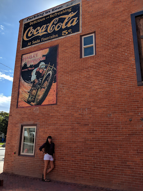
Next up we headed down the street a little ways to the new Harley Davidson museum that is being built (and almost finished) It was beautifully done with a variety of bikes and other HD memorabilia. We just had a quick look around at the work in progress but I’ll definitely have to come back when it’s all finished up.
Helper Points of Interest 
The Western Mining and Railroad Museum
Next door: The mining equipment and museum yard 
Balance Rock: A little too strenuous of a hike to attempt on any given day but easily seen from the town’s main street when just looking to the north
Big John statue
Spring Canyon: An easy walk where you can see the remains of coal camps that helped form the foundation of Helper 
The front entrance to the Harley Davidson museum 
A Short History of Helper 
Helper was first settled in 1881 by Teancum Pratt and his wives and was followed closely by the railroad only 6 months later. Helper was then named after the team of “helper” coal-powered steam engines that assisted freight trains up the neighboring Price canyon (a 15 mile long climb with a 2.4% grade) to Soldier’s Summit. With the railroad came the need for coal and thus the need for man power and immigrants. In 1900 Helper’s population reached 385 people made up of at least 16 different nationalities and after coal worker strikes in neighboring mines like Castle Gate, the population grew to 850 between 1912-13. Helper essentially became a “hub” with multiple businesses surrounded by several coal mining operations. Even with the Great Depression, the town’s position as a railroad center provided stability and through WWII the town had additional stability provided by the increased demand for coal. Now, even though the need for coal from the mines has declined (the actual Carbon power plant was closed just in 2015 after 60 years of running), the town survives and has become a center for art with several galleries lining its main street. The main street also plays host to a summer art and music festival, monthly markets called “first Fridays” and soon its own film festival
A short ways down the street we passed a fun “alchemy” art studio that had chalk out front so you can grace the sidewalk with your own art. There were lots of beautiful art studios along the street that worth are window shopping and peeping in. 
I loved all the fun artsy elements of main street Helper. 
Continuing on you pass loads more old buildings that all have descriptions of what they were when first constructed as well as a sign leading to what will be a nice waterway beach spot for playing during the warmer months
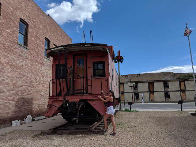
And then you come to the museum yard with old mining and railroad equipment. 
While you can’t climb up ON the equipment, a lot of the pieces were interesting to learn about and make fun photo props. Right next door is the Western Railroad and Mining Museum which is certainly called for (when it’s open) We unfortunately hit a Monday which during winter hours, it’s closed on. 

There were lots of beautiful old buildings to enjoy
The historic street is framed by 2 made over Conoco gas stations that again are fun to walk around for photos and admire that Cars land vibe. 

 After the gas station we turned and headed back down main street. 
I love how nestled it is among those desert cliffs. 
 After window shopping more art galleries, adding some sidewalk art, and all that walking, we worked up an appetite and obviously had to get lunch in the Balance Rock Diner. (review in my where to eat post here
And after lunch, we hit up the coffee shop across the street Happiness Within for some caffeine before our drive back to Utah County thus concluding a wonderfully relaxing afternoon stroll along the historic Helper thoroughfare. 

So whether passing through or looking for a close by weekend getaway, I definitely recommend stopping in Carbon County for museums, playing in the wonderfully diverse outdoor landscapes, gawking at ancient American rock art, and eating! 
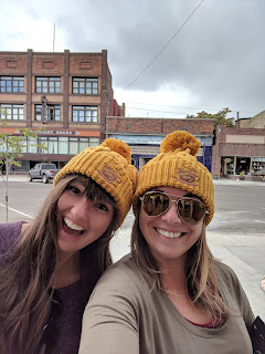
Katie and I with our Happiness Within Helper hats (and not shown here: Balance Rock Diner t-shirts) and definitely Helper fan girls now. I can’t wait to come back and explore more of this area. 

Desert Thunder Stock Car Races

Another Carbon County Success story: Getting to watch closing races of a 3 day event: The Castle Country Clash at the Desert Thunder raceway. Some of you who knew me years ago would know I was a big NASCAR fan back in the day. (I mean I made NASCAR board game for a 5th grade math project once…I was serious about it) 
So when Tina asked us if we would be interested in attending the weekend’s stock car races my answer was an easy YES! Saturday with our ATV ride, we were wiped out but luckily we finished our hike Sunday just in time for me to check out the afternoon races. 

The raceway is maybe a 5 minute drive from the highway in Price but feels completely out there in the desert. Tons of free parking and the entry booth exchanges your ticket for a raffle ticket at the start. There’s just a few buildings for concessions, announcers, and porter potties. LUXURY. 
Luckily I wasn’t there for comfort, I was there to see some racing! 

Concessions were decently priced and provided by the town’s historic Frosty Freeze (drive up). Everything looked pretty delicious I have to say!
My impression of the stands was awesome, while you can’t bring any food/ drink in you CAN bring a camp chair, blankets and the like. The main stands are actually giant concrete steps so you set you camp chairs up on that (or just recline/ spread out on one like I did) They did have bleachers around 3/4s of the track as well. 
Make sure to bring with you to ANY race: SUNGLASSES, SUNSCREEN ( I was really getting toasted), and if you attend a legit NASCAR race, hearing protection isn’t a bad idea.
*The cars were loud here, but not too bad. I could shout at the person next to me and somewhat hear their reply. 
A short history on Stock Car Racing:
It was born in the Southern Appalachians as people had a need to transport loads of illegal moonshine while evading the revenue agents. The 1934 Fords would get decked out/ modified and driven on twisting dirt roads in the dark, often exceeding 120 miles/hour. It became a popular event to find out who had the fastest car which lead to weekend races on make shift dirt tracks. From this start, NASCAR ( one of the most popular forms of Stock car racing) was born in 1948. Other forms of Stock Car governing bodies also started budding up. Dirt Track racing such as the Desert Thunder Raceway. have a more decentralized way of governing. There are some National boards for dirt track racing, but most are regional.
“Before there was a need for speed, there was a need for shine.”
~ Compliments of the NASCAR Hall of Fame. 
NASCAR/ STOCK CAR Racing Fun facts:
1. Today stock car racing is the second (arguably almost first) largest spectator sport in America, drawing ten million fans annually
2. Nearly all tracks are oval and less than 1-mile (1.6 km) in length (not withstanding tracks like the Daytona 500 which are 2.5 miles around)
3. Drivers do not typically need to wear diapers, regardless that their races last half a day sometimes.
4. During NASCAR races, the temperature in the car often exceeds 100 degrees, reaching as much as 170 degrees by the floorboards. Thus during a NASCAR 200 lap race, drivers can lose 5-10 lbs merely through sweat.
5. The first lady of Racing title goes to Louise Smith who secretly entered a 1947 race using her husband’s Ford Coupe. She raced until 1956 and won 38 races in various divisions.
6. Dirt tracks are much less difficult on tires allowing drivers to go several races without having to replace them. An asphalt track however will require at least one full tire change and many more in
a complete 500 lap NASCAR race.
7. Races can be anywhere from 20 laps to 200 lasting a mere 15 minutes to hours on end depending on how many cautions/ what kind of cautions are thrown.
8. At 200mph a Nascar goes the length of a football field in a second.
9. The top 5 NASCAR racing venues all have a bigger capacity than the biggest soccer stadium in the world. ** my favorite fun fact.. take that Soccer
   

The race I got to see had several divisions going on and I got to watch 5/7 of them. The one most of these photos is from is the hobby stock car division which had the MOST number of cars out of any of the races, ran a full 40 laps, and had the most wrecks. (At least 6 cars were towed out before the race was over) The other divisions included: Modified, Sport Modified, Classic Stock, Hobby, and my personal favorite: Dwarf. (bottom photo on this post has them identified in a photo) 
The video below shows 1 lap after the cars were coming out of a few caution laps (following a wreck) as they are just getting to take off and start racing again. 
Stock Car Racing for Dummies… At least know the flags:
1. Green Flag- Used to start the race and indicate when drivers can race again after a caution
2. Yellow Flag- Caution, used when unsafe conditions are on the race track: usually debris from crashes
3. Red Flag- Rarely used but potential in inclement weather or completely blocked tracks. Flag indicates to pull off into designated areas
4. Black Flag- Used for specific drivers to indicate they need a pit stop (leaking fluid or loose body work) or that they have disobeyed a rule
5. Black flag with white cross- Used if a driver ignores the black flag for more than one lap and indicates they can no longer be scored.
6. White Flag- indicates one lap left
7. The chequered flag- indicates the race is finished

While there are dirt track races and sophisticated NASCAR races happening all year round, every weekend, the Desert Thunder Racetrack only hosted 4 major events in 2018so it was perfect timing for me to check out the closing race of the year. 
Cost for the day is only $8 an adult, $6 for kids, with 5 and under being free. There’s also family passes for 2 nights around $25. 
Check here for the race track’s facebook page to follow along if interested in attending the next event. ( I know I am) Sunday races aren’t the norm down here so it wasn’t nearly as busy (which I liked) but if you come down for a Friday or Saturday event, make sure to come early to get a good spot. I heard the night time races were PACKED. 
Pano of the race track that is 3/8 mile long by 80 feet wide (the longest dirt track west of Denver)
The winners came out at the end of the race along with a few from the last race that just hung around. 
All of the events and divisions were fun to watch with lengths ranging from 20-40 laps. The Dwarf and Hobby were my favorite, but all cars have special techniques to racing that is just captivating to watch, particularly on a crazy dirt track like this one. 

Trail Guide- Gordon Greek Waterfall

Everyone knows I can’t go on a vacation without checking out at least one hike and in this case, the Gordon Creek waterfall was calling my name. 

Trail Stats:
Distance: 2.5 miles RT if you go all the way to the top of the falls
Elevation gain: 250 feet (there’s one decent up and one down each direction)
Kid friendly, dog friendly, ATV friendly. 

Driving Directions: 
Don’t over complicate this. Go ahead and plug Gordon Creek TH into google maps, it has the right location. It will take you from from HWY 191 onto Consumer’s Road and this is where it might get tricky. Google tried to convince us we needed to go through a coal weigh station but the truth is (while you can go that way when the gate is open) you want the left turn just before the plant. After a 50-100 feet you’ll cross a cattle guard and continue on this road until it merges with Trestle Road. From here google maps works like charm. The trailhead will be about 3.5 miles from where you turned off Consumer’s road and the gravel road is well graded with no pot holes (so family vehicle safe!) When you reach the trail head sign, park anywhere and follow the ATV road for the hike!

The ATV road/ trail is just to my right, follow it all the way to the falls!

 One short downhill section and you’ll be in my favorite area. Around the bend you’ll cross a small stream and head up a hill.

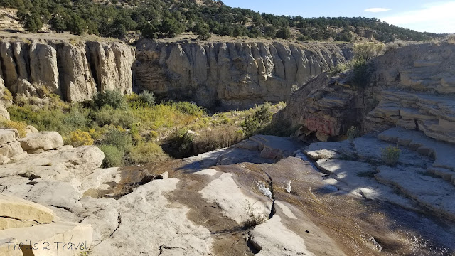
 Not too long after that you’ll be able to see the falls. We first headed to the top of the falls and then came back to that plateau to enjoy the view in front.

 Looking out across the top of the waterfall

 Trying not to slip

 Lots of places to sit, dip your feet if it’s a hot day, and a cool area to explore around the top of the falls… just take care not to slip.

 We wandered over to the plateau for a better look at the canyon that Gordon Creek flows through

 Not to mention the falls themselves

We had some time to kill so we spent about an hour sitting here with this view, enjoying some drinks and talking about life. We saw one other small family that shortly visited the falls before continuing back up the trail.. so all in all we had the area to ourselves! 

 As there was no one to take our photo… this was the best we could get with a giant pile of rocks and a phone on selfie timer haha

The trail will maybe take you 30 minutes each way. So the main time decision is how much time you’ll spend at the falls. Keep in mind that there’s no services anywhere along the road or at the trail head… so if you have 1 too many coffees at breakfast, or drinks during your life chat, plan accordingly.
AND PLEASE PACK OUT YOUR TRASH. 

After vising the falls, it’s an easy little drive on the trestle road just past the parking area to see the trestle bridge that crosses over Gordon Creek. (you could see it for a half a minute hiking back from the waterfall from afar)
The Gordon Creek Trestle bridge was built in 1912 and serviced the Mohrland Branch of the Utah line for almost 100 years. It saw it’s last train crossing 6 years ago, and unfortunately, part of the rail deck was burned and damaged so the bridge (in its current state) is not longer safe for use.

Map of the trail. The yellow dot is the trail head. The shorter detour pointing down is the road to the trestle bridge if you’d like to visit. (It’s definitely a cool checkout if you’re interested in trains, history, bridges, or all of the above!) 
**Bonus: If you have an ATV or bucket loads of time to explore, there is a cabin that is another couple miles (2-3) past the waterfall, and a SECOND LARGER waterfall another 3-4 miles past the main one. (So if you want to do all of that, you should plan on at least 8 miles RT, possibly 10 but seemed worth checking out.) Supposedly the ATV road goes almost up to the 2nd falls so if you have one of those, it would be a great place to explore! Enjoy! 

Fall Carbon County ATV ride

Fall Carbon County ATV Tour

Let me start off this post by saying that not only did this tour far exceed my expectations, but the entire area did. If you hear Carbon County, most people immediately ask “what is there to even do there,” “where is that?” Then you mention “Price” which is on all the road signs when you head from SLC to Moab and you get a few nods. 
WELL, time to change that.

I cannot believe I have lived so close (less than 1.5 hours!!) from such a beautiful place! Our tour was organized as part of the 
FIRST ANNUAL CARBON COUNTY FALL JAMBOREE

ABOUT THE EXPERIENCE:
The tour includes both breakfast before the ride, and lunch halfway through, organized leaders who will make sure you stay on the right path/ don’t get too separated from the group, and are ok in case of emergency. Not too mention you are guided with some of the best HISTORY experts on the area. We learned so much about the history of coal mining in the area! And did I mention the cost of this was $25 for first person on a vehicle, and only $10 for passengers?! 
**You do need your own or rent and haul in an ATV/ 4-wheeler/ QUAD/ whatever you want to call it

The tour was a full 8 hours and went up above 10,000 feet at Bruins Point passing old coal mine construction (more on that below) and incredible fall colors. Then it descended down Dry Canyon  to 9-mile canyon (basically the red rock desert we all know and love) before climbing up Cottonwood Canyon to alpine plateaus with WILD HORSES and back down to the starting point. Basically THIS. PLACE. HAS. IT. ALL.

Map of the route we took.

We met at 8 for what has to be the best breakfast I’ve ever heard of : Breakfast Pizza! with coffee and orange juice. We picked up our swag bags which included genius buffs (but bring your own just in case!) as well as a map of the roads we’d be taking, an awesome Carbon County Patch, water bottle, and more info on the area. We had a brief safety debriefing/ information meeting with the leaders of the group and then loaded up.

THERE WERE 37 MACHINES/ &70 PEOPLE
It was awesome! I’ve never experience what it is like to ride in a biker gang, but I’m pretty sure it was similar to this. Everyone lined up, flags flying, ready to ride on a beautiful fall morning. 

Oar Buckets on the 3.5 mile long cable way 

We rode a ways up admiring the fall colors that were changing, some old ruins of homes (from the early 1900s) as well as gawking at still standing, original and unaltered, oar buckets on a cable line. The towers supporting the cables were all still standing, and by all appearances untouched by time.

Half way up the mountain, we stopped to keep the group together, admire a tower up close, and get a little history lesson. The cable line that ran between the towers was constructed in the 1920s and ran 3.5 miles each way, making the line a total of 7 miles altogether. At the time, this was the longest continuous cable in the US. 

MORE ABOUT THE SUNNYSIDE COAL MINE 
1. Coal mining in the area got its start in the area in 1883 with the introduction of the Denver and Rio Grande Western Railroad company that needed coal for the trains.
2. Sunnyside started out as Whitmore Coal (in Whitmore canyon) in 1896.
3. The coal mined in the area was of good “coking” quality which means it was excellent for making steel. (by baking the coal in giant ovens, it forced out impurities leaving mostly Carbon behind) Giant coke ovens (650 of them) were created in the area to easily coke the coal before shipping it to areas in the Western US.
4. By 1909, the sunnyside mine was mining 3000 tons of coal/day and by 1914, furnishing nearly 300,000 tons of coke coal per day.
5. Unfortunately the the railroad and copper smelters that were the primary customers of the coke were switching to use of coal directly which made the Sunnyside mine less useful in the 1920s-30s. Luckily though, in 1942, Geneva Steel in Utah valley, and a steel manufacturer in California found plenty of use.
6. With the exception of the war years however, demand for coke was dropping off so the mine struggled. The ovens themselves operated until 1958 when they closed as well.  

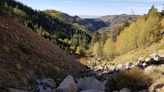
 Pretty fall colors as far as the eye could see

We stopped once more to see the tower where the cable originates before really stopping at the summit, Bruins Point. Here we took a slightly longer break for bathrooms (in the woods, no toilet here) and views of the fall colors surrounding.

 
Katie and I on the summit!

Then back on our respective rides to drive a longer ways down into the desert?! All the sudden it went from fall woods, to red rock canyons.

 TIPS TO HAVE THE BEST ATV ADVENTURE:
1. Wear layers! In the morning shade it was very chilly and at the top of the mountain all day it was windy and cold! Make sure you have a warm jacket/coat, and maybe a blanket to cover your legs!
2. On that same note, bring a good thermos to keep your hot drinks warm in the morning
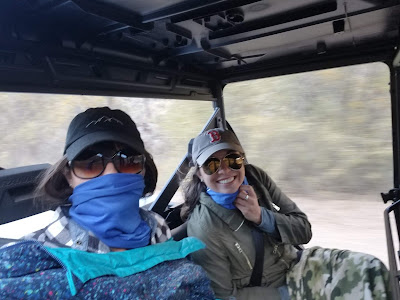
3. IT WILL BE DUSTY. Don’t wear your Sunday best, make sure to wear sun glasses/ goggles, and have a buff or scarf to cover your nose and mouth when it gets real dusty.
4. Also on that note, bring some nice wet wipes or baby wipes to periodically clean the dust from your face and hands. It makes a huge difference.
5. Bring a map of the area! We were in a tour led group, but there were diverting roads and paths that without a leader or a map could get tricky!
6. MAKE SURE YOU HAVE ENOUGH GAS FOR YOUR JOURNEY
7. Bring a speaker for music, cool drinks for when it gets hots, and have a blast!

 Stopping for another short re-group break. Amazing turn out for a first annual event!

 Driving through what felt like the Grand Canyon!

Before I knew it, we were admiring our first look at the Indian rock art in the area (which hardly anyone gets to see as we had not yet made it to 9 mile canyon)

See the rock art?

A short time later we were at our lunch stop in the Daddy Canyon Complex where a pit toilet was available, short hiking trails, and picnic tables were located.

We had our packed lunches (good sandwich, apple, bag of chips, and small dessert) along with our chilled beverages from the cooler, and then went exploring during our 1 hour break. We walked back in along the canyon admiring so many more petroglyphs!

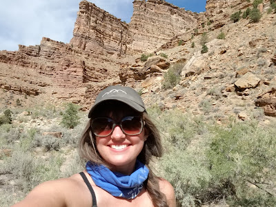
Taking my best guess at what some of the art means! 

Taking a lunch break to go for a walk in the desert

ABOUT 9-MILE CANYON & THE ROCK ART 
1. Wondering how 9-mile got it’s name? There’s a few stories out there, but the most likely comes down to when John Wesley Powell (ring a bell?) was exploring the Green River in 1869 ad used a nine mile transect for mapping the canyon.
2. 9-Mile Canyon was inhabited by native peoples for over 8,000 years with the most prolific artists of the area hailing from the Fremont people who lived in the area from 1100-1200 AD.
3. The canyon is often referred to as “The Longest Art Gallery in the World
as the entire canyon has amazing wall art in abundance.
3. Main points of interest include: An original homestead cabin at the cottonwood Glen Picnic Area, a Granary (ancient building walls) as well as a pit house, and tons of rock art. The most popular sites there are located around Balanced Rock and the Great Hunt Panel.

We had one more stop along 9-mile canyon to see the giant art of “The Great Hunt Panel.” A stop definitely worth checking out! In fact look around the corner to see a buffalo!

At this stop we were about half way through our tour and one of my new friends from the group, Boyd, offered me the chance to drive his side by side Polaris! Um YES! I was thrilled, so this backseat bystander transformed into a Motocross racer on a Side by Side. 

We turned up Cottonwood Canyon which while still being mostly red rock, seemed a different sort of dessert and transformed into more open high alpine plateaus. It was up here that we were treated with the icing on the cake so to speak:
WILD HORSES

 I’d always heard Utah was home to some wild horses, but had yet to see them with my own eyes. We started off spotting only 2 or 3 here and there before coming across the rest of the herd of around 20 horses, that all started running by.

At this point, my day couldn’t get much better but I guess I’d been impressing my ATV companion (with either my driving skills or chatting abilities.. I’m still not sure) and I was allowed to continue on driving. Needless to say, I’ve got a great new friend(s) from this experience!

Cottonwood Canyon eventually connected us back up to Bruins Point and we headed back down Spring Canyon past the old Oar buckets and finished where we’d started at Sunnyside park. 
A whole lot dustier than we started, but grins on our faces that couldn’t be wiped off. 

This was just the start of my discovery in Carbon County. More posts to come on hikes, historic towns, more ATV trails, and NBD: Stock Car Races. Stay tuned. 
**Sorry for the China post interruption, wanted to get this info out while there was still time left in the Fall season to enjoy!

I lucked out with amazing friends with ATV’s but if you have neither the ATV or connections, here’s a few spots you can rent one from. (Keep in mind you need to be able to transport the ATV from Spanish Fork to East Carbon, about 50 miles as there is currently no rental spot in Carbon County.)

1. TRAX® PowerSports of Provo: 801-613-8729

  • ATV (can fit 2 people) will run you $156-$195 per day depending on length of rental 
  • Side by side (2 people) is $196-$245 per day 
  • Side by side (4 people) is $220-$295 per day depending on model and length of rental
2. Summit Motorsports in Spanish Fork:801-405-7433 
  • Call for prices 
3. Toyitup Rentals in Spanish Fork: (801) 489-8697 
  • Call for prices