Everyone knows I can’t go on a vacation without checking out at least one hike and in this case, the Gordon Creek waterfall was calling my name.
Trail Stats:
Distance: 2.5 miles RT if you go all the way to the top of the falls
Elevation gain: 250 feet (there’s one decent up and one down each direction)
Kid friendly, dog friendly, ATV friendly.
Driving Directions:
Don’t over complicate this. Go ahead and plug Gordon Creek TH into google maps, it has the right location. It will take you from from HWY 191 onto Consumer’s Road and this is where it might get tricky. Google tried to convince us we needed to go through a coal weigh station but the truth is (while you can go that way when the gate is open) you want the left turn just before the plant. After a 50-100 feet you’ll cross a cattle guard and continue on this road until it merges with Trestle Road. From here google maps works like charm. The trailhead will be about 3.5 miles from where you turned off Consumer’s road and the gravel road is well graded with no pot holes (so family vehicle safe!) When you reach the trail head sign, park anywhere and follow the ATV road for the hike!
The ATV road/ trail is just to my right, follow it all the way to the falls!
One short downhill section and you’ll be in my favorite area. Around the bend you’ll cross a small stream and head up a hill.
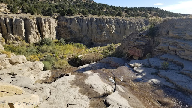
Not too long after that you’ll be able to see the falls. We first headed to the top of the falls and then came back to that plateau to enjoy the view in front.
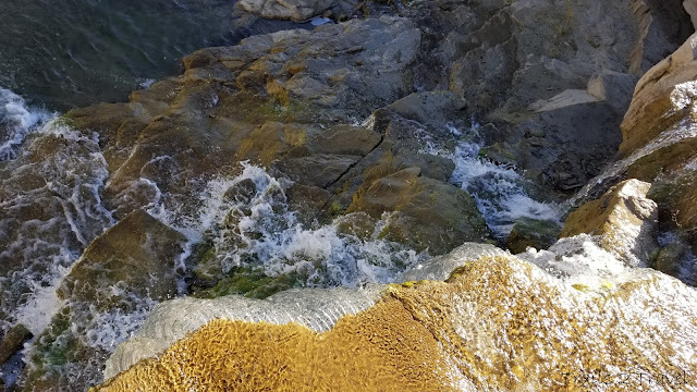
Looking out across the top of the waterfall
Trying not to slip
Lots of places to sit, dip your feet if it’s a hot day, and a cool area to explore around the top of the falls… just take care not to slip.
We wandered over to the plateau for a better look at the canyon that Gordon Creek flows through
Not to mention the falls themselves
We had some time to kill so we spent about an hour sitting here with this view, enjoying some drinks and talking about life. We saw one other small family that shortly visited the falls before continuing back up the trail.. so all in all we had the area to ourselves!
As there was no one to take our photo… this was the best we could get with a giant pile of rocks and a phone on selfie timer haha
The trail will maybe take you 30 minutes each way. So the main time decision is how much time you’ll spend at the falls. Keep in mind that there’s no services anywhere along the road or at the trail head… so if you have 1 too many coffees at breakfast, or drinks during your life chat, plan accordingly.
AND PLEASE PACK OUT YOUR TRASH.
After vising the falls, it’s an easy little drive on the trestle road just past the parking area to see the trestle bridge that crosses over Gordon Creek. (you could see it for a half a minute hiking back from the waterfall from afar)
The Gordon Creek Trestle bridge was built in 1912 and serviced the Mohrland Branch of the Utah line for almost 100 years. It saw it’s last train crossing 6 years ago, and unfortunately, part of the rail deck was burned and damaged so the bridge (in its current state) is not longer safe for use.
Map of the trail. The yellow dot is the trail head. The shorter detour pointing down is the road to the trestle bridge if you’d like to visit. (It’s definitely a cool checkout if you’re interested in trains, history, bridges, or all of the above!)
**Bonus: If you have an ATV or bucket loads of time to explore, there is a cabin that is another couple miles (2-3) past the waterfall, and a SECOND LARGER waterfall another 3-4 miles past the main one. (So if you want to do all of that, you should plan on at least 8 miles RT, possibly 10 but seemed worth checking out.) Supposedly the ATV road goes almost up to the 2nd falls so if you have one of those, it would be a great place to explore! Enjoy!


