Everyone knows I can’t go on a vacation without checking out at least one hike and in this case, the Gordon Creek waterfall was calling my name.
Trail Stats:
Distance: 2.5 miles RT if you go all the way to the top of the falls
Elevation gain: 250 feet (there’s one decent up and one down each direction)
Kid friendly, dog friendly, ATV friendly.
Driving Directions:
Don’t over complicate this. Go ahead and plug Gordon Creek TH into google maps, it has the right location. It will take you from from HWY 191 onto Consumer’s Road and this is where it might get tricky. Google tried to convince us we needed to go through a coal weigh station but the truth is (while you can go that way when the gate is open) you want the left turn just before the plant. After a 50-100 feet you’ll cross a cattle guard and continue on this road until it merges with Trestle Road. From here google maps works like charm. The trailhead will be about 3.5 miles from where you turned off Consumer’s road and the gravel road is well graded with no pot holes (so family vehicle safe!) When you reach the trail head sign, park anywhere and follow the ATV road for the hike!
The ATV road/ trail is just to my right, follow it all the way to the falls!
One short downhill section and you’ll be in my favorite area. Around the bend you’ll cross a small stream and head up a hill.
Not too long after that you’ll be able to see the falls. We first headed to the top of the falls and then came back to that plateau to enjoy the view in front.
Looking out across the top of the waterfall
Trying not to slip
Lots of places to sit, dip your feet if it’s a hot day, and a cool area to explore around the top of the falls… just take care not to slip.
We wandered over to the plateau for a better look at the canyon that Gordon Creek flows through
Not to mention the falls themselves
We had some time to kill so we spent about an hour sitting here with this view, enjoying some drinks and talking about life. We saw one other small family that shortly visited the falls before continuing back up the trail.. so all in all we had the area to ourselves!
As there was no one to take our photo… this was the best we could get with a giant pile of rocks and a phone on selfie timer haha
The trail will maybe take you 30 minutes each way. So the main time decision is how much time you’ll spend at the falls. Keep in mind that there’s no services anywhere along the road or at the trail head… so if you have 1 too many coffees at breakfast, or drinks during your life chat, plan accordingly.
AND PLEASE PACK OUT YOUR TRASH.
After vising the falls, it’s an easy little drive on the trestle road just past the parking area to see the trestle bridge that crosses over Gordon Creek. (you could see it for a half a minute hiking back from the waterfall from afar) The Gordon Creek Trestle bridge was built in 1912 and serviced the Mohrland Branch of the Utah line for almost 100 years. It saw it’s last train crossing 6 years ago, and unfortunately, part of the rail deck was burned and damaged so the bridge (in its current state) is not longer safe for use.
Map of the trail. The yellow dot is the trail head. The shorter detour pointing down is the road to the trestle bridge if you’d like to visit. (It’s definitely a cool checkout if you’re interested in trains, history, bridges, or all of the above!)
**Bonus: If you have an ATV or bucket loads of time to explore, there is a cabin that is another couple miles (2-3) past the waterfall, and a SECOND LARGER waterfall another 3-4 miles past the main one. (So if you want to do all of that, you should plan on at least 8 miles RT, possibly 10 but seemed worth checking out.) Supposedly the ATV road goes almost up to the 2nd falls so if you have one of those, it would be a great place to explore! Enjoy!
Day 5- our 2nd day on the mountain. We were both kind of waking up around 5:30 and noticed lights of people/ groups out hiking to a peak to watch sunrise. We both had rough sleeping, but felt good enough at least so we got dressed, gathered our small pack of things, and headed out to check out sunrise. In the interest of not getting up early enough and being hungry for breakfast, we only did the short walk back to the cloud dispelling pavilion where we’d watched the sunset. I wish however that we had just done the jaunt up to Purple Cloud Peak as that was probably the best/ closest peak to our hotel and was tall enough we would’ve been able to see the East side of the mountain.
Ah well, still not a bad view from the pavilion.
We hung around for 10-15 minutes as the sun was already almost up when we got there. The views and affects were similar to the night before… no morning clouds/ fog for us. Then we checked out of our hotel and grabbed breakfast around 6:15 (narrowly avoiding the rush) and I will say breakfast was decent. They had a large array of food, I mostly stuck with rice porridge, rolls, hard boiled eggs, and a ton of fruit. But they had lots of “noodle” options and even toast. They also had an intriguing “orange juice” that was basically orange fanta made from boiled water. So it was hot. Haha at least we knew it was safe.
Then we were headed out onto new terrain. We backtracked to complete the loop in the center and take the path b Xihai hotel up to Bright top. There were a few “hotel” paths that looked like they may be the one we wanted but had no signs so that confused us but eventually we found the sign and trail split we were looking for (further East of the hotels). In other words, if there isn’t a sign, it isn’t the path. Hahaha!
Morning light filtering through all the pines. We really hoped we’d spot a monkey, but alas… we did not.
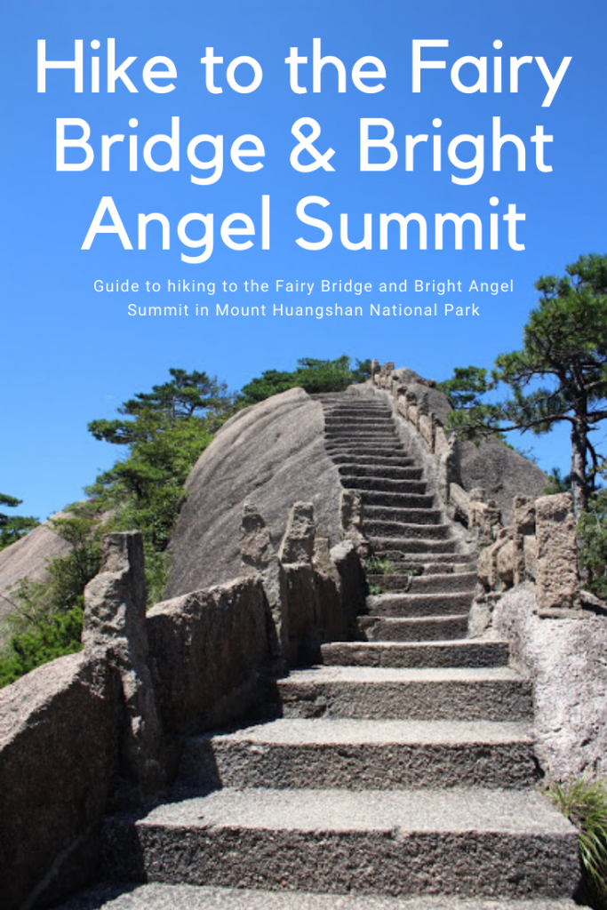
It was a pretty strenuous up hill walk to Bright Top with stairs continuing forever. It took us at least 30 minutes and we were definitely over it. While the trees were pretty, there wasn’t much of a view and thus I deem this path not really worth doing.
Beautiful reservoirs of water that act as holding tanks on the mountain. While the area gets a decent amount of precipitation, it definitely still needs plenty of water to support all the visitors and hotels!
Made it to Bright Top (view again looking toward the Western Sea)
Trail Stats from Paiyunlou Hotel to the Mercy Light Pavilion (bottom of the Western Steps)
Distance: 8.3 miles
Elevation Gain:1,300 feet
Elevation loss: 3500 feet
Estimated time: 4-6 hours
*These figures are based on maps I saw with distances and elevations of the points of interest called out and are rough estimations.
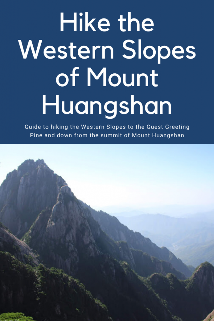
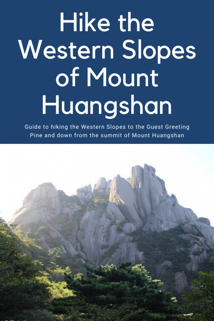
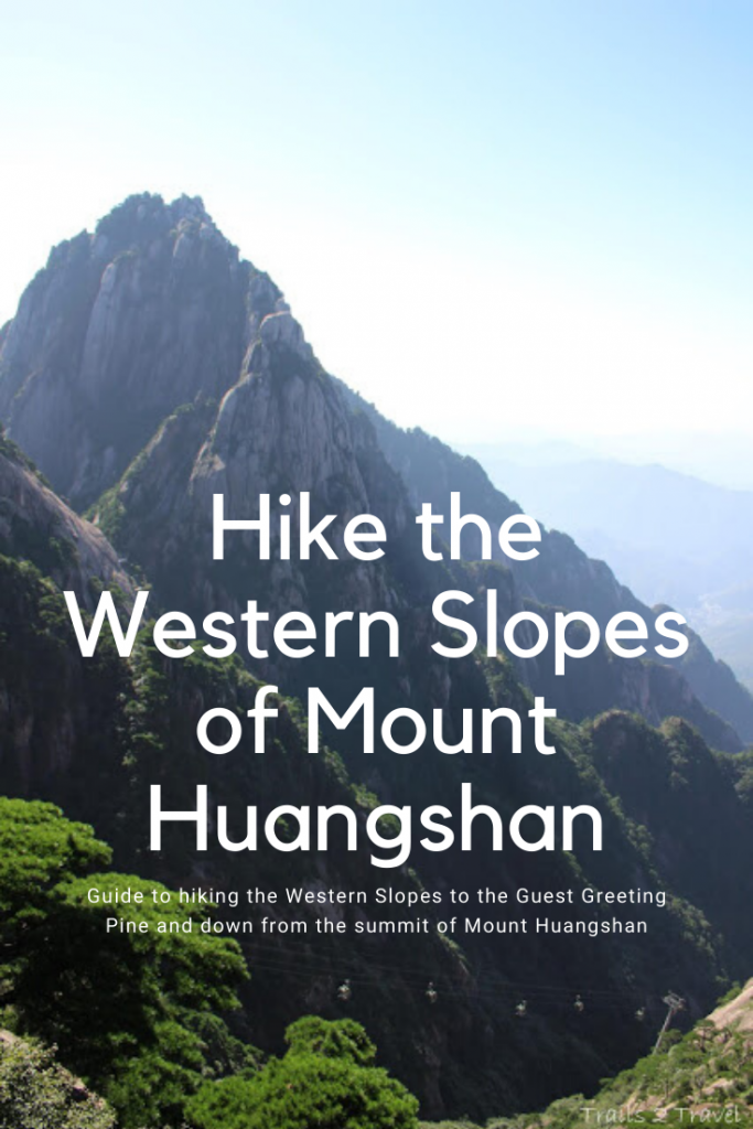
Points of Interest: Turtle Peak (separate trail), Lotus Peak (closed to peak bagging but you can see it), Celestial Capitol Peak, and the Guest Greeting Pine .
Peaceful morning on the trail
Looking up at Bright Top, the main focal point of the mountain by diving it into quarters
On Bright Top looking over at Turtle Peak (a great sunset/sunrise spot if staying at the Baiyun hotel)
Clouds way in the distance
Once at Bright Top, it was easy to continue following the signs for the “Yuping scenic area, otherwise known as the “western steps” and the path we planned to take down off the mountain. This side was pretty unique with the granite tops being more rounded and boulder-y looking than the peaks on the Eastern steps.
We were glad we started early!
The craziest part of this mountain were the numerous porters offering their services to carry people. And there were.. several people that we passed taking them up on that. (this lady we are pretty sure was carried all the way from the Baiyun hotel area to the top of the Yuping cable car.
Prices for reference! Only $15 to be carried 2 km! (one of the more flat paths I suppose) .. but like what?!
While I couldn’t myself pay someone to carry me, I don’t blame some of the older folks as this side of the mountain was a LOT of up and down. One part was the steepest set of stairs we came across on the mountain (maybe ever), “the ladder to heaven” and unfortunately we had to go up it.
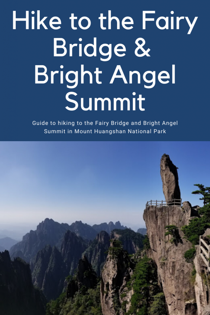
Our first view of the incredible Celestial Capital Peak.
We walked for probably another hour-1.5 hours before we started seeing the crowds from the Yuping cable car (getting to the area then right around 8:30 or so)
You can see the Yuping cable car far down below it. (those were also already very high for reference)
A cool part of the trail walking under some boulders.
My favorite! Pine trees!
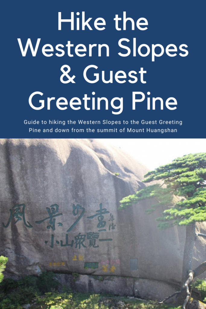
And then we hit the crowds full stride close to the Guest Greeting Pine and entrance to the cable car. If you want to have the tree to yourself, you’re going to have to start pretty early. As bad as this looks however, the distance to the tree wasn’t too bad and it took maybe 15-20 minutes or moving through the queue to actually get to the tree.
I affectionately refer to this tree as the Mona Lisa Tree because I have NEVER seen SO MANY PEOPLE trying to take selfies and pictures with 1 thing. It was hard to even get close; I basically scaled a small rock and even then I couldn’t get a great photo of it. I tried for a bit to have my photo taken with it when one lady really nicely let me down my small rock to stand in front of it. It’s still a terrible photo though so not sharing it here. haha
Once we took the trail past the tree, the crowds dropped off a fair amount but still a steady number of people seemed to be heading for the Capitol peak.
Which when I saw it, even I thought they were crazy. The stairs looked a lot like the “ladder to heaven” stairs and seemed never ending. They must’ve climbed 1000-1500 feet almost immediately with no break. (I’m talking worse than Angel’s landing- steep STEEP stairs) Granted our previous day had left me tired and somewhat sore, but even feeling fresh I don’t know if that peak would’ve held appeal for me.
But neither would what we ended up doing as it would turn out. My one piece of advice when it comes to exploring this mountain, is to TAKE THE CABLE CAR. On either the Eastern or Western steps, please don’t try to hike down them, and seriously don’t go about walking up them. While I’d read the scenery was much better on the Western steps (hence I chose to take the cable car up the East steps, and WALK down the west steps) I found it never ending stairs and boring. Seriously the steps. Never. End.
You hardly get any scenic views and just see a lot of trees. Save your time and energy for hiking the peaks up at the top and just take the cable car.
At the bottom of the western steps walking path, there is a beautiful building that sometimes seems to serve as a visitor center, and a shuttle bus stop. We bought our tickets back to Tangkou and hopped on.
Which, here comes mistake #2 of the day. We forgot that bus stop map photo I’d taken and so when the bus turned down a different road than we expected, we panicked and got off at the first stop. At that stop we were harassed with sellers as soon as we got off so we hurried away from the station. It wasn’t until we were well past the station that we saw the buses were going back to the main road and thus… were going the way we had wanted to go. *face palm
At this point we just continue to walk thinking the hotel we’d left our bag at was just down the road 10 minutes or so
We got off the bus WAY too early. Our stop we wanted was the very last one on the route!
That “10 minute” walk became a blazing hot 30 minute walk with little scenery. By the time we reached the hotel, we were dehydrated and exhausted from our walk DOWN the mountain and then through town.
The light at the end of the tunnel dawned however as we ate at the restaurant yet again (our favorite.. it was so good) and decided that since we had 6 hours until we needed to leave for the train station and had nothing to do, we may as well book a room. Lolololol Weird, I had a hard time explaining that since we were taking a sleeper train to Shanghai that night, we wanted a place to shower, change, and NAP before we headed on our next phase of our journey. $35 well spent my friends. That green tea foot soak was just as great on this day and the nap was even nicer.
At 5:30 we picked up some snacks/dinner for the train and our hotel called us a cab to take us to Huangshan train station. Here’s where it gets good again. Even though I clearly say HUANGSHAN and not HUANGSHANBEI I notice on google maps that our cab driver is taking us through weird back streets, neighborhoods, and most definitely NOT the most efficient way back to Huangshan town. When I tell him not to go to Bei, he doesn’t understand and thus we end up at Huangshan Bei (the HIGHSPEED train station that we’d first arrived at) anyways. So now we have an hour to go before our train departure. We show him our train ticket and say other station a few times and he gets it. So then we are off on another 20 minute ride back to the run down station in town. We did try to pay him extra for having to drive us further but he ended up giving it back to us instead of accepting it. Ah well. In we went where we had about 10-15 minutes wait in the large waiting room, and then we got on our train.
Photo from our next sleeper train, I didn’t get any of this one
It was an older style train for sure, with clunky sliding doors. They were bunk room compartments since we booked a “soft” sleeper so our bunk room had 4 bunks with Braden on the top bunk and I had the lower. We happily discovered that our bunk room was shared with a couple from the Netherlands who I enjoyed talking with for a 2-3 hours about our different experiences on the mountain and around town. It was even the latest we stayed up since we had our ramen noodle bowls and chatted for so long.
Sleeping was an experience. I slept rather well considering it was on a train, but overall I still only got maybe 5 hours of sleep. While maybe not the most “restful” sleep, I found the movement of the train comforting, and my individual bunk comfortable. The train provides a sheet to lay on top of, a decent pillow, and a really nice comforter. So moral of the story, I probably wouldn’t hesitate to book a soft sleeper again.
And thus concludes our epic trip around the Huangshan area, stay tuned for a recap post for hotel, trail maps, and useful tidbits to come all in one post!
Day 5 Costs: Breakfast included in hotel Shuttle bus to Tangkou $5.54 Lunch $19 Extra hotel… $35 Store $8.45 Taxi to train station $26.23 Sleeper train $99
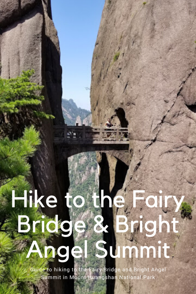
Day 4, part 2 continued: The hike to the Fairy Walking Bridge.
Once we reached the bottom we took the Northern rail car back up to the top which spit us out near the Baiyun hotel. (where I would personally recommend staying for location and reviews) We debated going to check in at our hotel but the day was still young (it was only 11) and we were right at the top of the SOUTH trail around the Western Sea. This was the trail I originally planned on taking all the way down but was told it was closed half way.
Map of the trail to the Fairy Walking Bidge, then to Bright top peak to Flying-over Rock, and then onto our hotel. I circled Purple Cloud Peak even though we didn’t trek up there, as it would have made for an excellent sunset/ or sunrise spot.
The top of the rail car was nice and serene. We stopped for a rest before continuing on along this beautiful tree lined path.
The Southern path was still open to the Fairy Walking Bridge (even though it was closed just after) so we debated looking for lunch/ checking into our hotel or heading down. Since we were RIGHT at the start of the trail, we decided it would be our best bet to just do the trail first. The hotel advisor said it would take 2 hours RT to visit the Fairy Walking Bridge but there were signs at the start that said 2 hours TO it. Rest assured, it was a leisurely 40 minutes down to it for us.
Looking across the way to the Northern Route you can actually see the path in several places if you look hard enough.
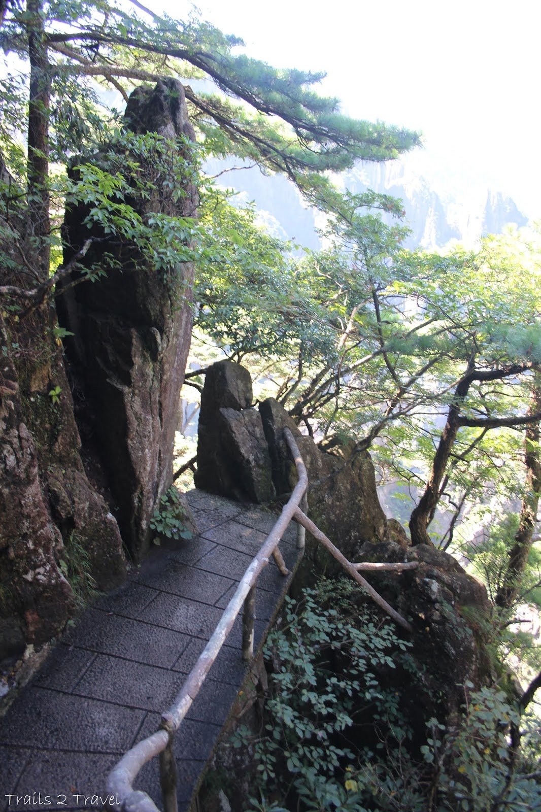
The trail was WONDERFULLY devoid of people. We only passed 2-3 other small groups of 1-2 people each going down. No groups or loud speakers here. And while the trail wasn’t overhanging sheer cliffs, it did beat an amazing path through stone which I found equally beautiful.
Trails Stats from the Rail Car to the Fairy Walking Bridge AND Hotel :
Distance: 7 miles
Elevation Gain:1,400 feet
Elevation loss: 1,400 feet
Estimated time: 3-5 hours
*These figures are based on maps I saw with distances and elevations of the points of interest called out and are rough estimations.
Points of Interest: Turtle Peak (looking up at it), the Fairy Walking Bridge, The Western Sea Grand Canyon overlook, Bright Top Peak, Flying- over- rock.
The Western Sea overlook
There were so many lovely views and sections of trail here, as well as lovely stone picnic table spots to take a short rest at. If I were to visit this mountain again, I would still prioritize this trail.
Getting close. When you see the incredible pine tree cliff and look down to see the terrace, you are just about there.
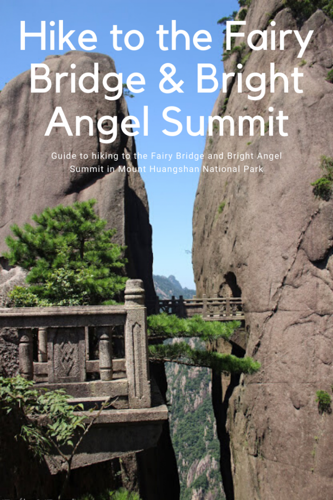
YES! Made it. We actually passed through the tunnels and crossed the bridge already to get to this spot on the terrace.
The view looking from the bridge toward the terrace. It was amazing being surrounded by such tall, sheer cliffs.
The South- West of Huangshan mountain, mountains everywhere!
Looking up the sheer cliffs that somehow a trail weaved its way down
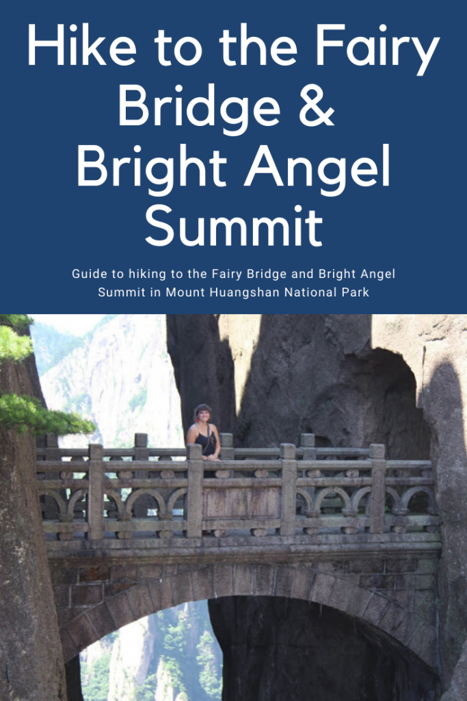
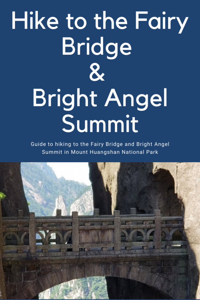
a cute “little” fairy bridge
Crossing the main bridge
balanced rocks easily seen from the terrace
How is this place even real?!
favoite
I wish I could tell you this epic bridge was constructed centuries ago by gravity defying monks fleeing religious persecution or something cool like that, but alas this was just built in the 80s to connect another one of the valley trails to the top of the mountain. (Amazingly we actually saw a few backpackers hike up from the valley this way)
Looking down the crevice from ON the bridge… a long way down!
Crossing back across the bridge to return.
Unfortunately the lighting, was terrible for the time of day we were at the bridge, with half the bridge in shadow making photos hard to get right. We waited around an hour or so to see if once the bridge was completely in shadow it would help. It didn’t really since the other wall was still so bright. So hungry and running low on water, we decided to call it and head back. It only took us 45 minutes hiking back but we were pretty tired and thirsty by the end.
Trail signs!
Hiking back along this stunning trail
Lookig at the “flying rock” from the summit. You can see our hotel off on the right a little ways further
When we reached the Baiyun hotel, we bought the first bottle of water we found and realized we still had more up to do… We had to go up and over the Bright Summit to get to our hotel. (and this is why I recommend staying at the Baiyun hotel… hahaha)
Looking back up towards the bright top summit.
We made it to the summit in only about 15 minutes (of straight stairs) and picked the path my hotel receptionist told us to go on day 1 to our hotel. I imagined it as only 30 minutes walk but man… it was a tough walk of 3 km and almost an hour! We had a few more ups and a LOT more downs to do before reaching our hotel. It was still so hot. Thankfully I’d bought a souvenir fan down in town because I used that thing constantly. (Probably looked ridiculous, hopefully not offensive… but a necessary tool)
As exhausted and frazzled as we were, we couldn’t just walk on by without capturing this incredible “flying” rock.
A sea of clouds… and mountains
We finally made it to our hotel around 3:30 and checked in. Unfortunately we were on the top floor of a 6 story hotel that lacked an elevator which meant.. more stairs. It was pretty run down inside and the layout was pretty bizarre… and don’t get me started on the room. Definitely our worst hotel of the trip (and 5 times as expensive as our hotel the night before) The 2 twin beds in our room were basically box springs with yellowing comforters. We found a few small beetle like bugs around the room, which left me on high alert for bed bugs. No A/C either which after sweating all day, made the room an un-welcome relief. Needless to say, we were pretty appalled. Did I expect luxury on top of the mountain? No but at least a little better than what we ended up with.
Dinner….
Anyway the show must go on, no matter how thoroughly exhausted we were, we still had hours in the day. We showered and rested a bit before going out in search of food. The hotel just before ours, Xihai seemed like an easy enough walk and a little more fancy so we thought we’d check their restaurant out… WELL It was closed for some reason. (5:30 PM…) so we’d walked that way for nothing. We headed back to our hotel which appeared to have a restaurant and a street food type vendor. Apparently they are one in the same. What was advertised as pick 3 entrees , rice, and soup was really, you get what you get: which in this case was 3 questionable entrees, rice, and hot seaweed water. It was pretty terrible. The thing on the left was more seaweed? With some other texture, probably tofu, that I couldn’t quite accept. The middle dish was just eggs and tomatoes so a little better, if at least edible. The last entree was sweet potatoes and the safest of them all. The hot sea weed water was as bad as it sounds, and rice was rice.
Anyways, if you come here, just do yourself a favor and haul some ramen noodles up in your back pack. And if you don’t want to carry them, buy those at the little stores up top instead of trying to eat any of the street sidewalk food.
We ate what we could and headed back down to the Cloud Dispelling Pavilion which was thankfully an actual easy walk (with few stairs) from our hotel for sunset.
Crazy sun beam peaking over the mountains. The lighting and colors were just crazy beautiful
After hanging around for a while, we decided to continue along the Northern route again (the first hike we did) at least until we started to descend a lot of stairs. It was just so peaceful without all the people and with the magic lighting on the mountains. We probably went about 3/4s of a mile or so to the start of the descent where the tunnels start and what I’d consider the “opening” of the Northern route
No this is NOT a scene from Star Wars: The Last Jedi. What you’re seeing is the Cloud Dispelling Pavilion everyone.
We caught some pretty sunset light at the Purple Cloud cable car station (and spotted the peak where most people apparently go to watch the sunset- Purple Cloud Peak)
Another view from further away of the Cloud Dispelling Pavilion with our hotel Paiyunlou behind it.
The start of the tunnels and major descent down on the Northern Grand Canyon route.
(This spot is maybe a 30 minute walk from the Cloud Dispelling Pavilion)
Exploring the narrow passage with the dying light
Straight drops from this viewing platform- you can see why these mountains are the
“Yellow Mountains”
More views from along the trail at sunset
Almost dark- so headed back to the hotel
Sea of Mountains
We stopped at the little convenience shop on the way to pick up a coke and oreos to follow up our terrible dinner and spent the rest of the evening in our room. Thankfully at night it cools off SIGNIFICANTLY and with the window open, the room was just right. The room also had a nice small but deep tub that I soaped down and soaked in which was extra nice. Though we slept terribly due to fear of bed bugs (we had yet to spot any) it wasn’t as bad as we thought it might be. (because neither of us actually got bitten by anything)
So solid day! So glad we made it down to the Fairy Bridge and caught such a glorious sunset. Day 4 part 2- SUCCESS.
Day 4 Costs:
Breakfast from store: $10.20
Shuttle to scenic area $4.08
Entrance to park $33.50/adult $16.75/student
Yungu Cable car ride $23.32
2nd tram ride/ Western Sea Rail car $29.15
Large bottle of water $3.64
Dinner $20.11
Oreos and a coke to end the day $5.10
2nd best day of our trip (after the Great Wall) as the mountains and sites we saw this day were EPIC. but let’s get things straight.. this day was a TONNNN of stairs.
Our hotel receptionist told us 9AM would be a good time to head up so we didn’t set an alarm but my jet lag woke me up at 3 anyways. I killed some time waiting for Braden to wake up and started noticing tour groups around 5:30. (the first buses to the scenic area leave at 6). So we decided to just get up and get ready. We got some breakfast from the store across the street. (The owner was so friendly! She didn’t speak any English, but she gestured to her mouth and looked like she was asking us if we needed breakfast, and when we nodded yes, she took us directly to the BREAD section. About died. She knew exactly what I wanted. Hahaha) So snacks in hand, we checked out of our hotel, leaving our big bags there and walked the short distance to the scenic bus stop. (literally our hotel was the closest one to the stop)
“Civilized travel starts from me” … words to live by! haha
We bought our tickets for the Yungu Temple which was the start of the Eastern steps and Yungu cable car then queued to get on the bus. This area was SO organized, it was like Disney again. While it was getting busy, we just slowly followed everyone through the lines to get on a ready busy and once it was full, it left immediately for the scenic area.
We were feeling.. pretty proud at this point not going to lie. The bus ride was around 30 minutes and climbed at least 1,000 feet with sharp switchbacks passing through Bamboo forests before coming out in more open alpine plains.
View from the winding bus ride
Once off the bus, it was a short walk to the ticket counter (no lines yet) to pay our entrance fee to the mountain as well as buy a cable car ride to the top. The entrance fee was pretty EXPENSIVE, so if you are a student, make sure you bring your ID as it makes the cost less than half! Braden thankfully had brought his… I wish I still had a valid one. Haha There was a shorter 15 minutes line to board a cable car which we shared with 4 others (2 couples) who didn’t seem to enjoy the ride much. They looked pretty terrified.
Following Braden along the path from the bus stop to the cable car ticket counters
Giant sign right before the ticket counters for park entrance and the cable car
I found the cable car ride pretty thrilling. It was SO beautiful as all of the granite peaks we slowly unveiled the higher we got. Admittedly there were sections that were over such steep drops, I myself was a little afraid… particularly when the wind started to blow our cars. We reached the top after about 10 minutes and were immediately surrounded by hordes of tour groups whose guides spoke with large speaker phones.
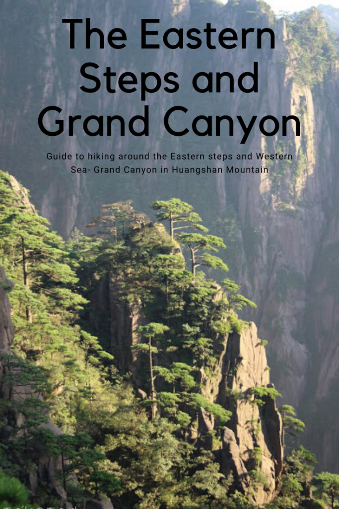
So WITH that, here was our plan for our first hike and first half of our day:
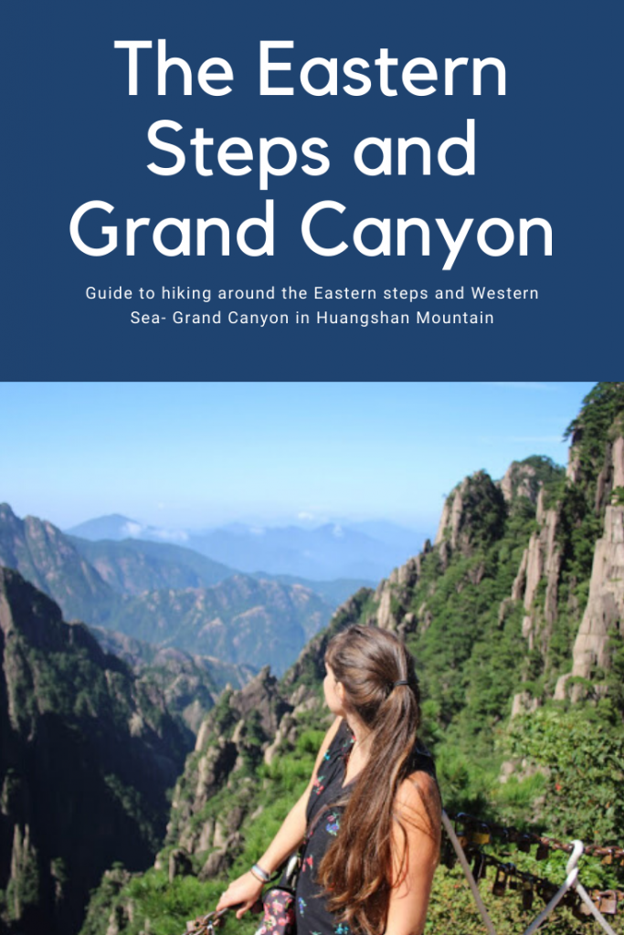
Yungu Temple to the bottom of the West Sea Grand Canyon
Distance: 4.5-5.5 miles
Elevation gain: 500-900 feet
Elevation loss: 1300-1500 feet
Time: 4-6 hours
*These figures are based on maps I saw with distances and elevations of the points of interest called out and are rough estimations. The shorter distance/ time is if you go straight down with the longer distance/ time if you add in Beginning to Believe Peak and Lion Peak.
Points of Interest: Beginning to Believe Peak, Stone Monkey Watching the Sea, Cloud Dispelling Pavilion, and just about everything after that.
We snapped a few photos around the top of the cable car before hurrying away down the path to try and stay ahead of them. But it was too late. We should’ve started earlier as even though we passed several groups, there were always more ahead. By this time it was almost 8AM. I had an idea of where the mountain would be less crowded so we skipped the Beginning to believe area which I’m sure put us in front of many tour groups.
We reached the Beihai hotel very quickly and decided in the absence of too many tour groups there, to detour up and check out the “stone monkey”
The views were absolutely stunning of the surrounding peaks around us and though we skipped the peak, I was definitely “beginning to believe.”
These little trash receptacles were everywhere and I have to see this mountain was kept IMMACULATELY clean. If we saw trash, it was in these bins, but we also saw the bins being clean out frequently. So it was awesome how well they are managing trash up there… even if the amount of plastic waste is astonishing.
After a fair bit of stairs, we reached the monkey! Do you see him? This was one amazing view!
A photo with the monkey! We had our breakfast snacks we’d brought along up here where it was quiet. We concerned going the short extra distance to Lion Peak, but it was closed, so we headed down back to our original path instead.
Amazing views near the Dawn Pavilion.
After hiking down from the monkey, I used the public toilet at Beihai hotel which was horrible, but then again, on the main path for giant tour groups and by this time (8:30ish) was getting very busy. Recommend holding off until getting to the next hotels if you can.
Story of our day.
A view more of the views around Beihai hotel.
It was maybe a 30 minute walk from Beihai to Xihai hotel, and then another 15 minutes or so to our hotel at the start of the West Sea Grand Canyon (North) route, the Pai Yun Lou hotel. We unfortunately had to weave in and out of several tour groups along the way but seemed to make decent headway.
The path was pretty easy to follow with all of the signs at cross roads having the English names so as long as you knew where you wanted to go, you’d get on fine. The map we had showing the trail intersections was also helpful so between that and the signs, you really can’t get too lost.
The worst bit, was that way more groups were headed for the West Sea than I expected. All the information I had read (from 2013 and older mostly) indicated this area of the mountain was scarce with people… well that’s a load of baloney.
No matter though, as this area is worth the crowds, the hype, and the multitude of stairs
The Cloud Dispelling Pavilion
There were moments on the path that were people free and glorious! And there were moments we couldn’t appropriately enjoy because of the people blocking views or speaking loudly into speaker phones. Overall however the trail was so unique, beautifully crafted, and with incredible views, that it would be impossible to not appreciate it.
A really narrow part of the trail. I enjoyed running through it and having freedom to move period as up until this point, the crowds were pretty thick.
Views looking south and of the west sea. (our 2nd hike this day would take us over there)
Some of the many stairs. We had to descend like 3000 feet in around 1.5. Stairs were a necessity.
Worth it.
I left Huangshan with a deep obsession and love of these pine trees.
You will see many, many more photos highlighting these beauties…..
Some more stairs….
Some of the pretty details of the trail. Everything was rock solid but detailed to look like pretty pavers or wood. While I didn’t enjoy the crowds, I did enjoy the unique structure of this trail that basically hung over massive drop offs the whole way.
I spy, a boyscout.
One of the other few spots on the trail we had to ourselves
The trail looked like this most of the way, just jutted right out of a sheer cliff.
More stairs.. but pretty ones at least
Floating stairs
Once at the bottom of the Western Sea- Grand Canyon you can hike back up (not recommended) or you can just pay the $15 or so for a rail car ride back to the top. #worthit
We didn’t see a SINGLE person climbing up these stairs. haha no one is crazy enough to do it I guess. IF the southern route which also connects down to the rail car station had been open, I may have been tempted to climb up a different way but alas, it was closed. (I’m really torn up about it)
Finally at the bottom thus concluding our first “hike” of the day. We had a short wait for the rail car to take us to the top and then we’d start the 2nd trail of the day. More information about the hotels on the mountain to come.